The Real Estate Price Register (RCN) is a public register that contains data on real estate market transactions, based on information derived from notarial deeds.
Under Article 7d, point 1(b) of the Act of 17 May 1989 – Geodetic and Cartographic Law, the authority responsible for maintaining the RCN is the district governor (starosta).
According to the Regulation of the Minister of Development, Labour, and Technology of 27 July 2021 on land and building records, RCN data is made available through web services, following the detailed specification outlined in Annex No. 10 to the aforementioned regulation.
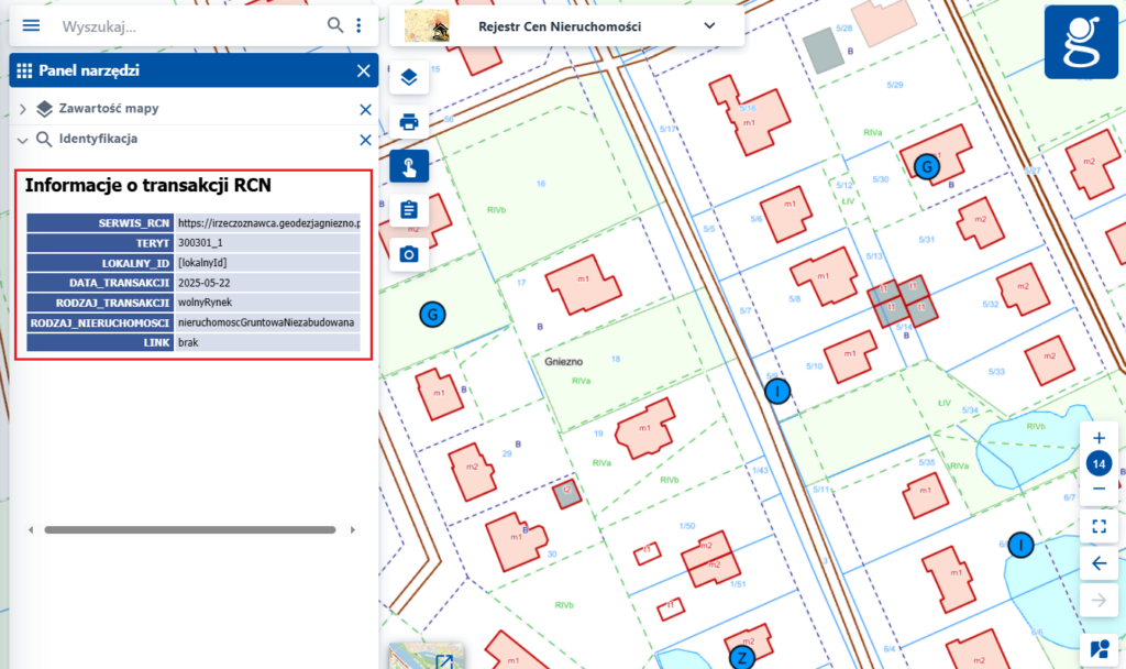
It should be emphasized that neither the viewing nor download services provide access to the part of RCN data that contains information about transaction price or specific property characteristics. Access to such information requires payment, as set out in the pricing tables attached to the Geodetic and Cartographic Law.
Through the WMS web services, users can also obtain free information regarding the spatial distribution of transactions. It is also important to note that the link for previewing and purchasing individual transaction data is optional.
The Chief Surveyor of Poland provides access to the National Real Estate Price Integration (KICN) service through the National geoportal website www.geoportal.gov.pl.
The KICN service is an aggregated service that works as a proxy for information on transactions sourced directly from countries. The service is available at: https://integracja.gugik.gov.pl/cgi-bin/KrajowaIntegracjaCenNieruchomosci
The aggregated KICN service includes data only from those counties that provide their own viewing service (WMS) registered in the Spatial Data Sets and Services Registry.
The KICN service is continuously updated as additional viewing services (WMS) are registered by counties. Counties that have submitted the address of a viewing service (WMS) for the RCN dataset, and whose services have been integrated into the KICN, are marked in purple on the map below.
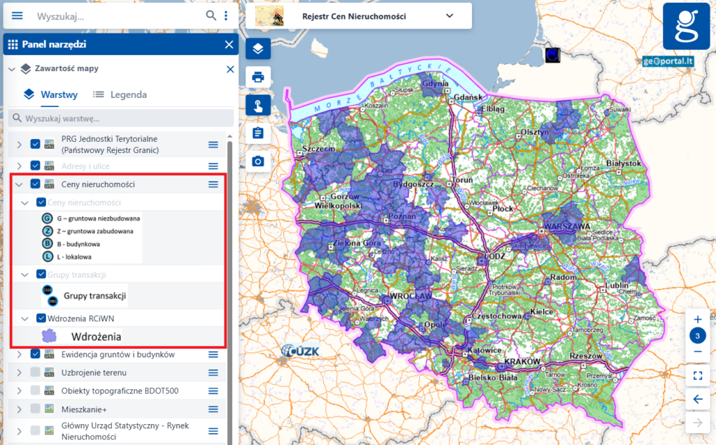
The KICN service can also be connected to any software capable of handling the WMS standard interface.
The aggregated KICN service providing access to transaction data was developed to meet the needs of spatial data users and to illustrate the intensity of real estate market activity on a national scale.
The correct operation of this aggregated service depends on the proper performance of the county-level services and their adherence to the defined specifications.