Topographic features collected in BDOT500 databases together with, among others, objects of land and building registration or utilities network make up a large-scale base map. The BDOT500 databases are maintained by heads of counties, which results in 380 units being responsible for maintaining them.
In 2019, the Head Office of Geodesy and Cartography (GUGiK) integrated the publication of data on topographic features from counties in the KIBDOT collection, including other data from the counties. The idea of service integration is identical to the integration of services related to utilities networks or land and building registration. An example of an image obtained from KIBDOT is shown in Fig. 1.
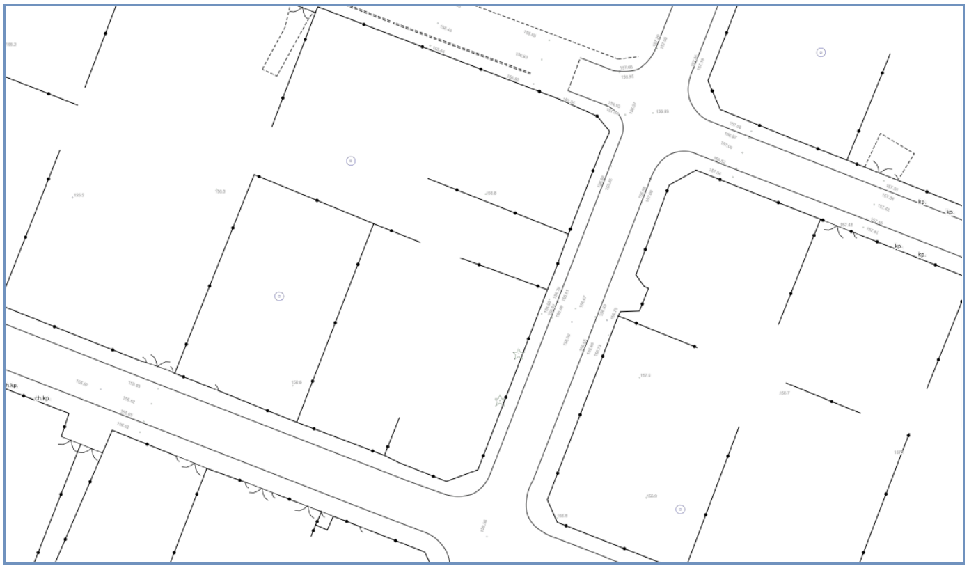
A query used to generate the image of Fig. 1 can be found here.
For technical details regarding the service, see: https://integracja.gugik.gov.pl/cgi-bin/KrajowaIntegracjaBazDanychObiektowTopograficznych.
Browsing topographic data
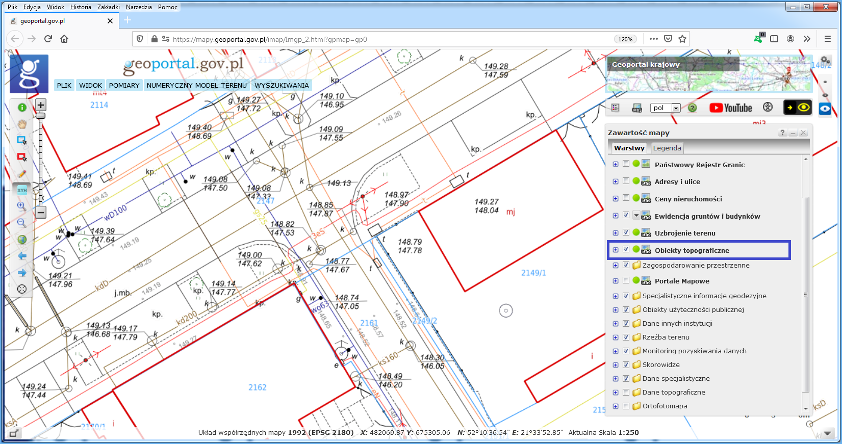
To browse topographic feature data, go to www.geoportal.gov.pl, where KIBDOT is connected and configured in a way that allows users to browse details of topographic features in the context of other useful spatial information.
The “Topographic objects” layer is displayed automatically while browsing data for scales of 1:500 and 1:250. To display topographic features for other scales, check the layer visibility (Fig. 2).
This service can also be connected using software with a WMS client component (see: https://integracja.gugik.gov.pl/cgi-bin/KrajowaIntegracjaBazDanychObiektowTopograficznych). The results obtained by connecting the service in QGIS are shown in Fig. 3.
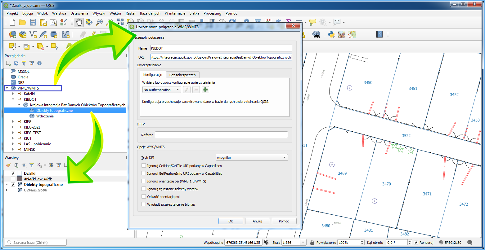
Connected service should display topographic features per layer configuration set by the user.
Note: Topographic feature data is made available in return for payment; therefore, at the moment, there is no common download service available.