The utilities network databases (GESUT) contain information about the existing and designed utility lines and related infrastructure. They are maintained by the heads of counties which means that there are 380 units responsible for maintaining them. Data on the utility networks is extremely useful in the investment process, for real estate valuation and in other situations that require revealing the underground infrastructure.
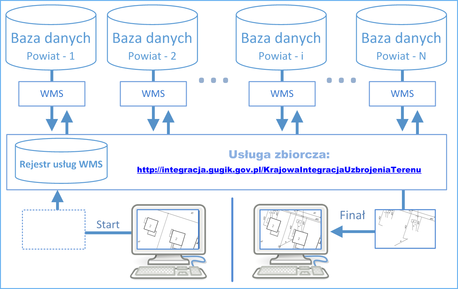
In the second half of 2018, the Head Office of Geodesy and Cartography (GUGiK) integrated the publication of utilities network details from each of the counties in an aggregate KIUT service. This allowed providing general access to data via web services, enabling the use of data on utilities networks in the national information systems and systems created by commercial companies. KIUT is an aggregate WMS intended for generating maps of utility lines for any area of the country. The concept of KIUT is presented in the diagram below (Fig. 1).
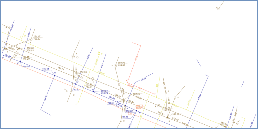
Example of image obtained from the service is shown in Fig. 2.
For all the technical details regarding the service, see: https://integracja.gugik.gov.pl/cgi-bin/KrajowaIntegracjaUzbrojeniaTerenu.
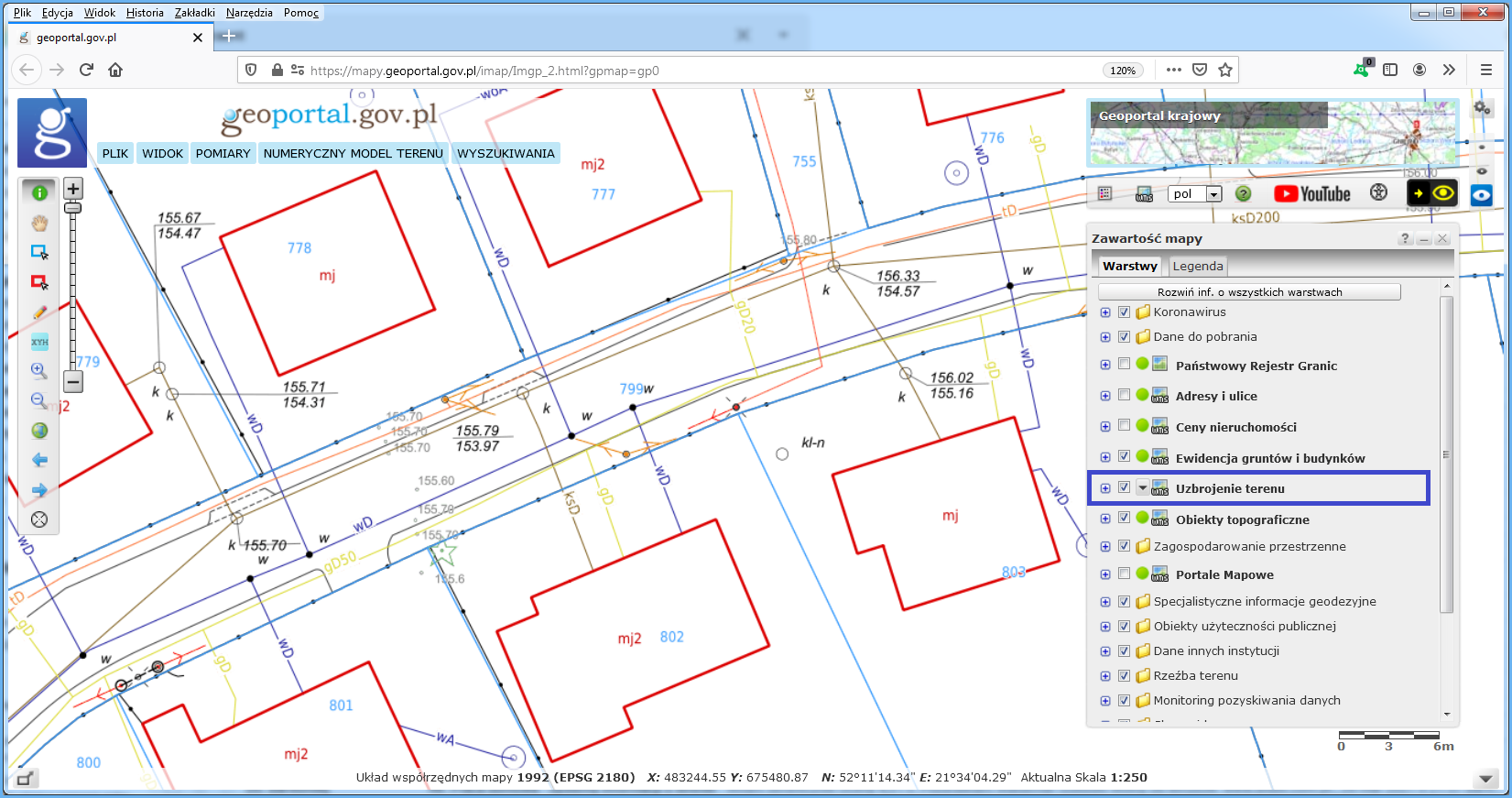
To browse data on the utility lines, go to www.geoportal.gov.pl, where the aggregate WMS service is connected and adequately configured in a way that allows users to browse data on the utility lines in the context of other useful spatial information.
“Integration of utilities network” layer is displayed automatically while browsing data for scales 1:500 and 1:250. To see utility lines for other scales, check the layer visibility (Fig. 3).
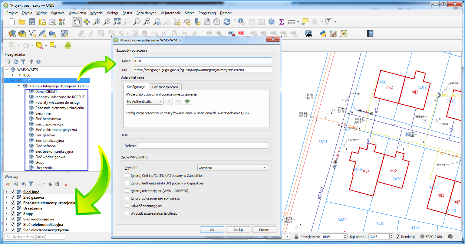
This service can also be connected using any software with a WMS client component (see: https://integracja.gugik.gov.pl/cgi-bin/KrajowaIntegracjaUzbrojerniaTerenu). The results obtained by connecting the service in QGIS are shown in Fig. 4.
Connected service should display utilities network details for any area of Poland per layer configuration set by the user.