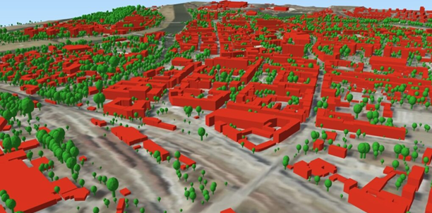
3D models of trees represent trees with a height of over 4 meters. To indicate the location and the maximum height of an individual tree, there has been created a 1-meter grid from airborne laser scanning (ALS) points of a high vegetation class (by rounding the X, Y coordinates to whole meters), which along with a neighborhood analysis has allowed for the isolation of an individual tree and determination of its maximum height. 3D models of trees have been developed in the City GML 2.0 standard, as a part of GUGiK’s own work using Safe Software’s FME software.
3D models of trees have been generated automatically based on current data available in the national geodetic and cartographic resource, i.e.:
- point cloud (developed using ALS technology – airborne laser scanning) – the high vegetation class,
- Digital Terrain Model (grid interval 1.0 m).
Every 3D model of tree has the following attributes:
- object identifier (gml_id)
- data source (zrodlo)
- data source accuracy (aktZrodla)
- tree height (height)
- ground level height of the tree (h_nmt)
3D models of trees are available free of charge and free to use.
Downloading data is possible from the www.geoportal.gov.pl website, where in the “Data for download” section you can see a group of layers “Topography” -> “3D Models of trees” and there in turn the layer “Trees LoD1” (“Trees LoD1-2023“).
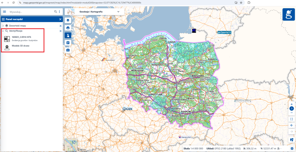
Using the identification tool, click on the map within the boundaries of the district for which you want to obtain data. As a result there is displayed a list of available layers (see figure below). Then select from the list “3D Models of treess“.
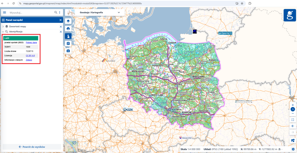
In the information window (see figure below), there are appeared information of the selected district and also a link to download the 3D models of trees.
To display and process data, you can use e.g. free of charge QGIS software.
If you have any questions please contact the Photogrammetry Department of the Head Office of Geodesy and Cartography, that is responsible for development of the 3D models of trees, phone: (22) 56 31 374, e-mail: foto@gugik.gov.pl