The Land and Building Register is maintained by heads of counties, which results in 380 units being responsible for maintaining them. The EGiB data, and in particular the data on cadastral parcels, are the primary reference data for the presentation of various other objects and features collected in spatial information databases. In addition, a parcel number in conjunction with a district number is often assigned as an attribute to many objects that are located on that parcel. Then, if we are able to find a parcel, we are able to access the objects located on it at the same time. It is also significant that registered parcels are the second important spatial location reference of objects after addresses. The capability to convert the parcel number (identifier) to its spatial location (geometry) is an important feature for developers of any systems related to spatial information, because it allows easy implementation and sharing.
Fragmentation of land and building register databases does not mean, however, that at the national level we have to deal with the resulting difficulties. Adequate aggregate services became the solution to this problem since they allow operating across the country.
In the second half of 2018, GUGiK integrated the publication of land and building register data from the counties in aggregate services. The purpose of the project was to provide commonly available web services to enable the use of land and building register data in the national information systems and systems created by commercial companies. The services in question include:
- KIEG – (National Integration of Land Records) – a WMS service which allows users to generate land and building register maps for any area of the country.
- ULDK – (Cadastral Parcel Location Service) – a service for the location of cadastral parcels which enables spatial location of a specific parcel based on its identifier, district name and parcel number, or based on X,Y coordinates of any point within it.
Complete technical details of these services can be found at their respective websites, namely:
KIEG is a WMS aggregate service which allows its users to generate a land and building register map for any area of the country, and its essence is the feature that allows them to download information from one of the 380 county servers. The concept of the KIEG is presented in the diagram below (Fig. 1).
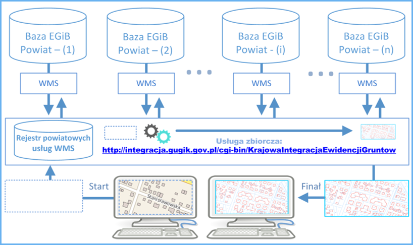
The actions presented in the diagram above can be described by the following sequence of actions required to use the KIEG:
- the user uses only one address of the WMS aggregate service (i.e.: https://integracja.gugik.gov.pl/cgi-bin/KrajowaIntegracjaEwidencjiGruntow) and does not have to remember the addresses of each service at a county level;
- the user of the aggregate service sends thereto a map generation request for the browsed area, including his or her own defined configuration of information layers;
- based on its register of information concerning county services, the aggregate service queries respective services in the user’s area of interest to generate data image (map) from particular counties;
- when all responses from one or more counties are well received, a combined data image (map) is created for the query and returned to the user as an appropriate graphic file.
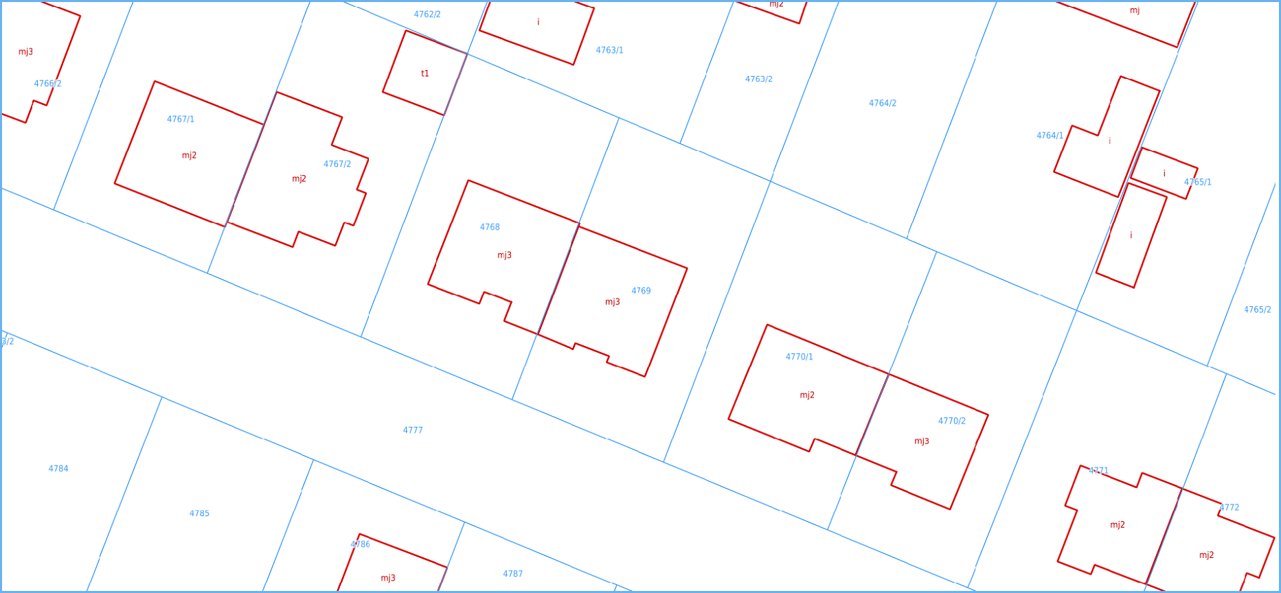
An example of a query used to generate the image shown in Fig. 2 is at:
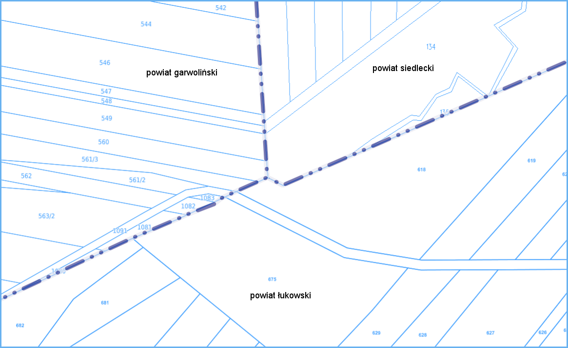
Queries that require data from the area of more than one county are simple for KIEG users because the service automatically gets images from all the counties included in a query pane (Fig. 3).
By appropriately configuring the KIEG query parameters, you can obtain a land and building register map image from any area of Poland.
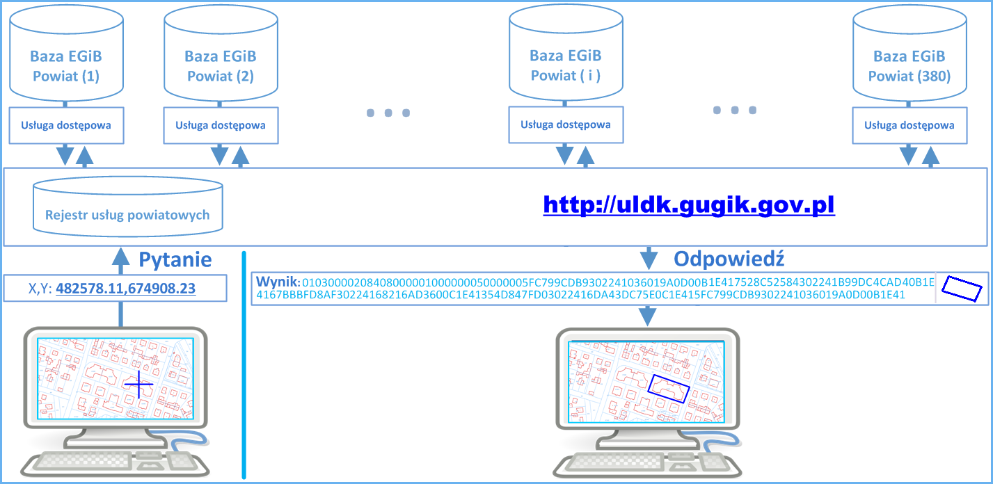
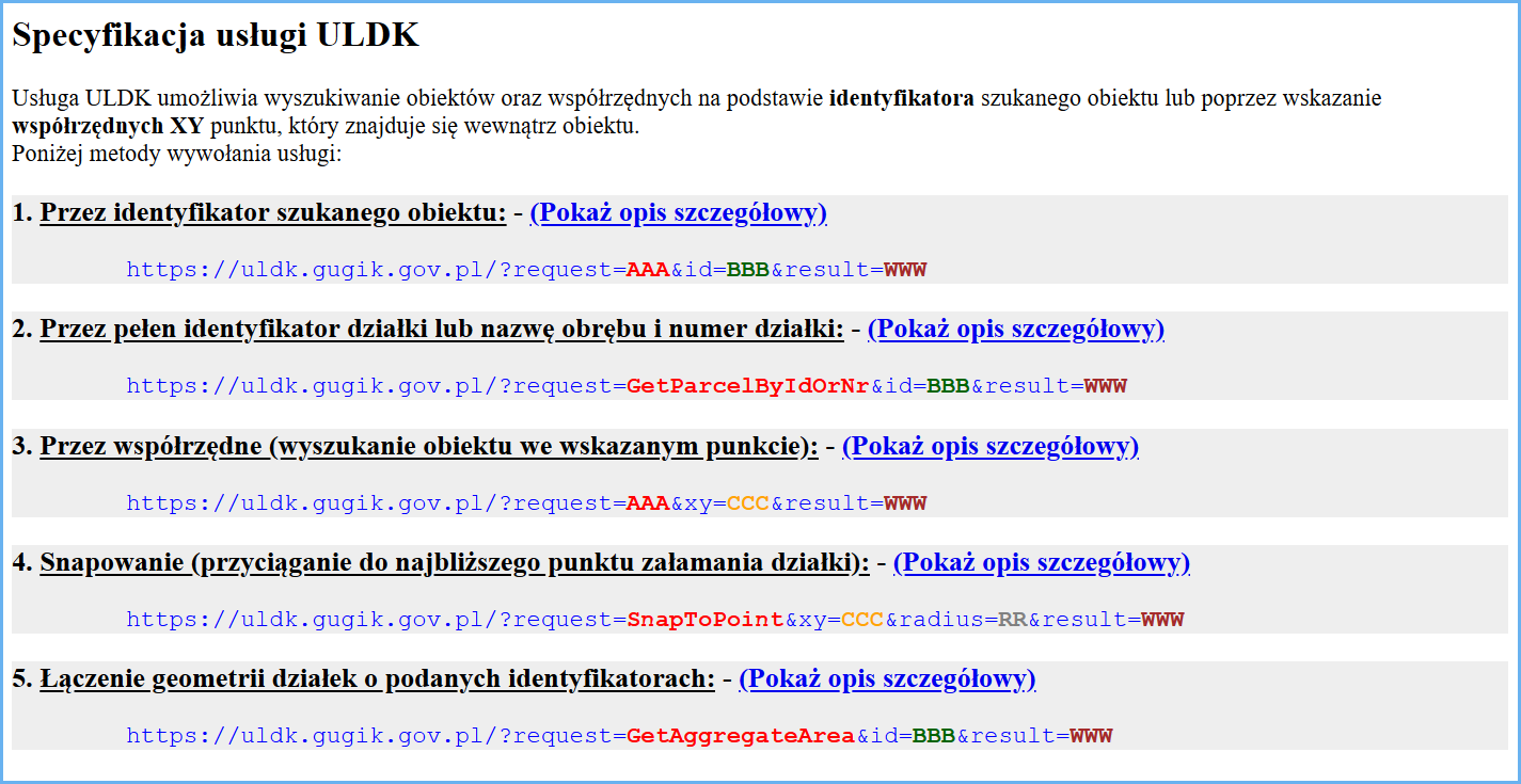
The ULDK is a cadastral parcel location service. It enables the spatial location of any parcel situated in the territory of Poland based on its identifier, district name and parcel number, or based on X,Y coordinates of any point within it. Figs. 4 and 5 show ULDK functional diagrams for the location using both an identifier and coordinates.
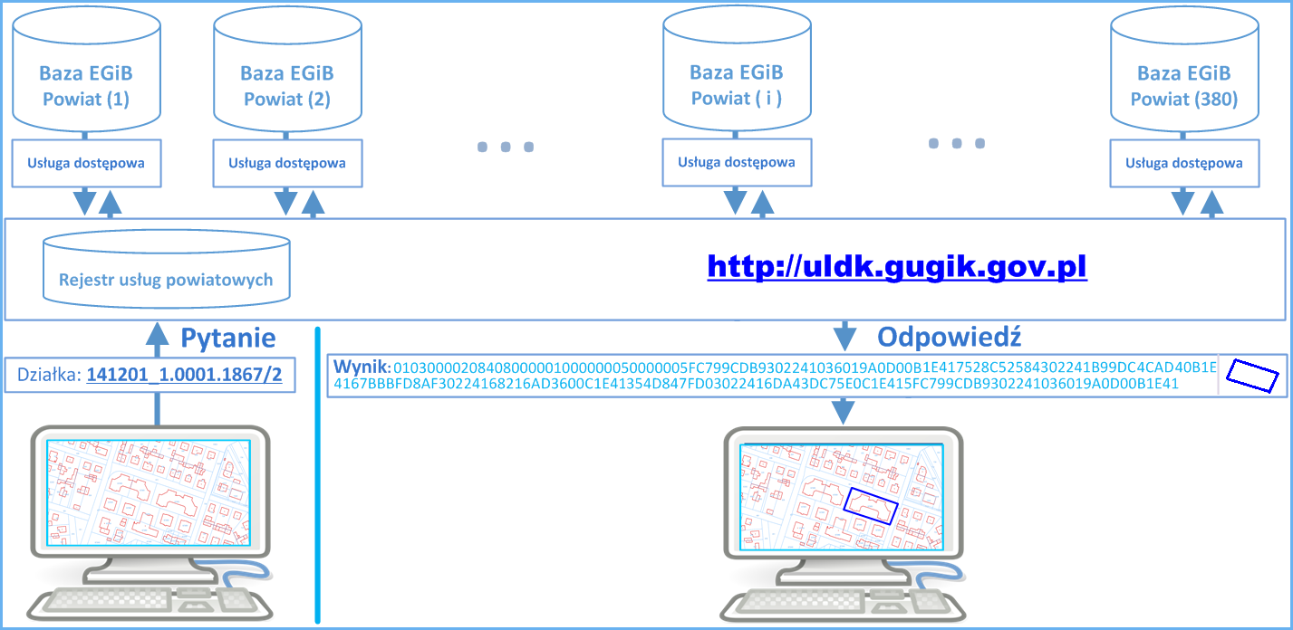
Poszczególne wywołania mają postać:
- https://uldk.gugik.gov.pl/?request=GetParcelById&id=141201_1.0001.1867/2
- https://uldk.gugik.gov.pl/?request=GetParcelByXY&xy=630889.87,497178.59
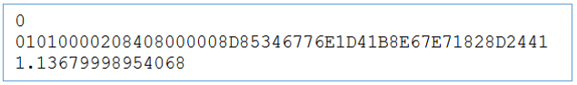
The query may include a coordinate system ID along with spot coordinates (by default, the coordinate system is EPSG:2180, i.e. PUWG1992). By default, the parcel geometry is returned in WKB format implemented in most of the dedicated systems for spatial data processing. Typically, a parcel location query with no additional parameters returns a resulting file which consists of two lines.
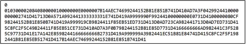
The first line refers to the response status, whereas the second one represents a parcel geometry in WKB format. Parcel geometry is only returned if the parcel is found, i.e. when the response status is zero. Otherwise, the file contains only a single line with the query status.
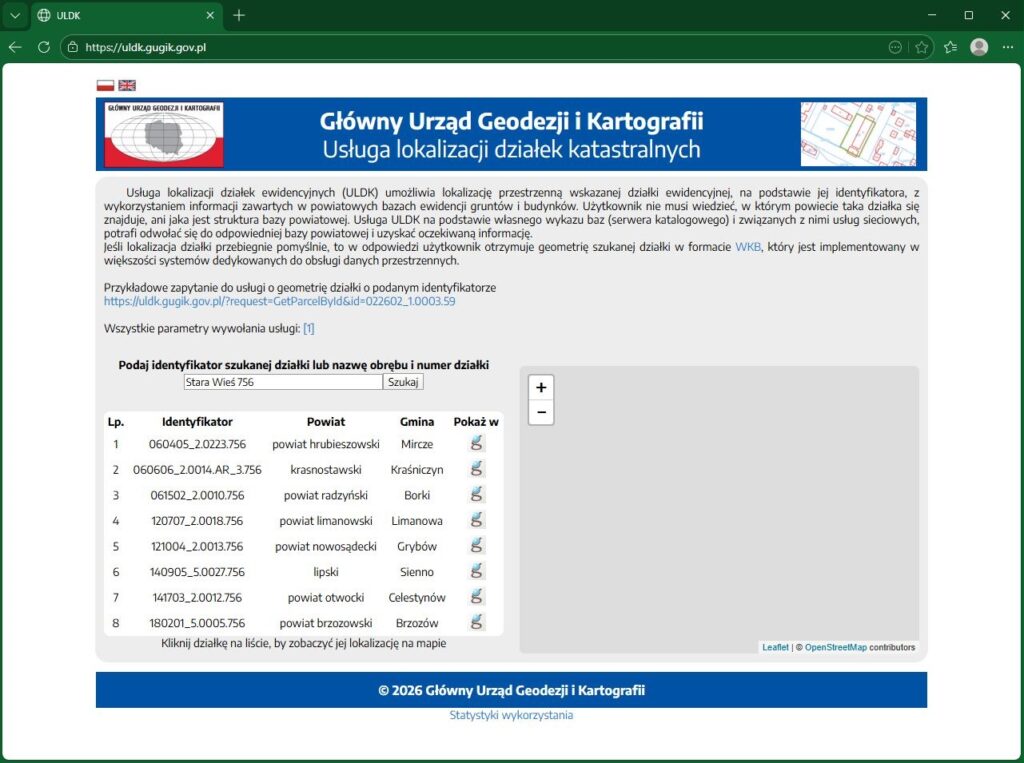
Results can be different for queries based on a district name and parcel number which are not always unambiguous and might return more parcels due to duplicate district names, e.g. a query for parcel 756 in district Stara Wieś:
https://uldk.gugik.gov.pl/?request=GetParcelByIdOrNr&id=Stara Wieś 756
returns a file containing information about eight parcels from different counties:
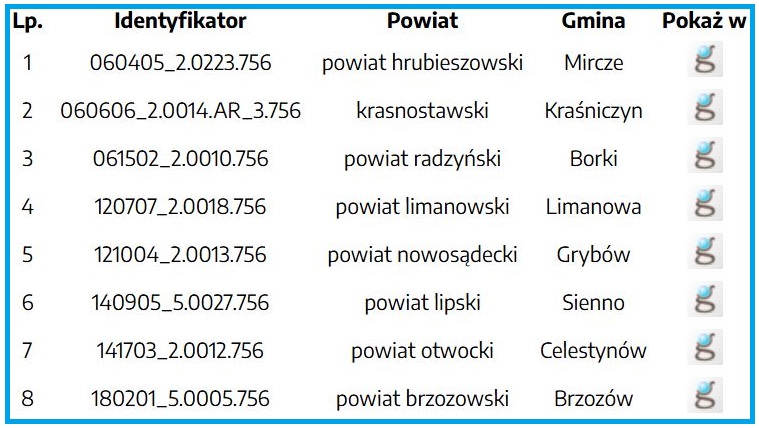
If you make queries which include district names, apart from more than one result, you can also expect a longer response time because the query must be processed by all the counties with districts of the specified name. For example, the query „Dąbrowa 12” returns as many as 57 parcels that meet the search criteria.
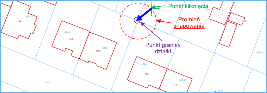
Apart from basic location-related functionalities of the ULDK, it also supports some additional functions. One of them is snapping to the closest point of a cadastral parcel. An example of a query is specified below and the result is shown in Fig. 8
https://uldk.gugik.gov.pl/?request=SnapToPoint&xy=482206.91,673473.54&radius=3
The result is a file which consists of three lines:
The first line contains the response status, the second one contains point coordinates in WKB format, and the third one contains the actual distance between the returned point and the point whose coordinates are provided in the query.
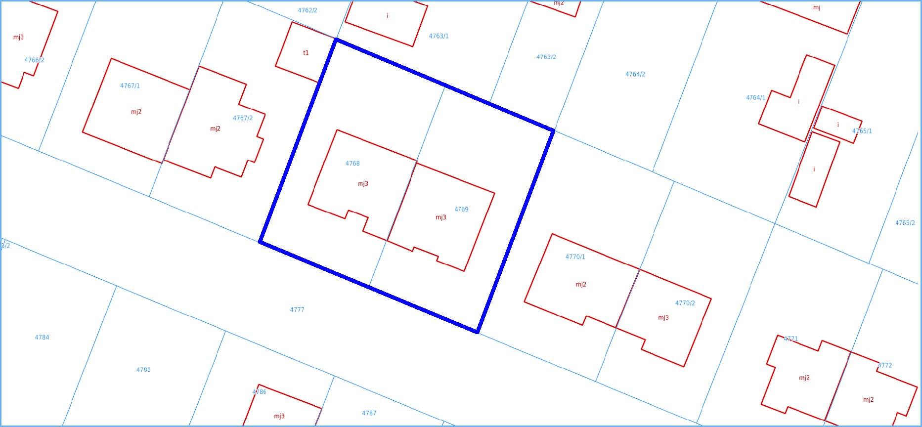
Another functionality is the aggregation of a few objects included in the register (parcels, districts or communes) into a single geometry. An example of a query is specified below and the result is shown in Fig. 9.
For all the technical details on how to use the ULDK, including the description of all the query parameters, see https://uldk.gugik.gov.pl.
EGiB data can be browsed using a WMS aggregate service which is by default connected to www.geoportal.gov.pl. However, the service can also be connected to any software that supports such standard (WMS address: https://integracja.gugik.gov.pl/cgi-bin/KrajowaIntegracjaEwidencjiGruntow). The results obtained by connecting the service in QGIS are shown in Fig. 12.
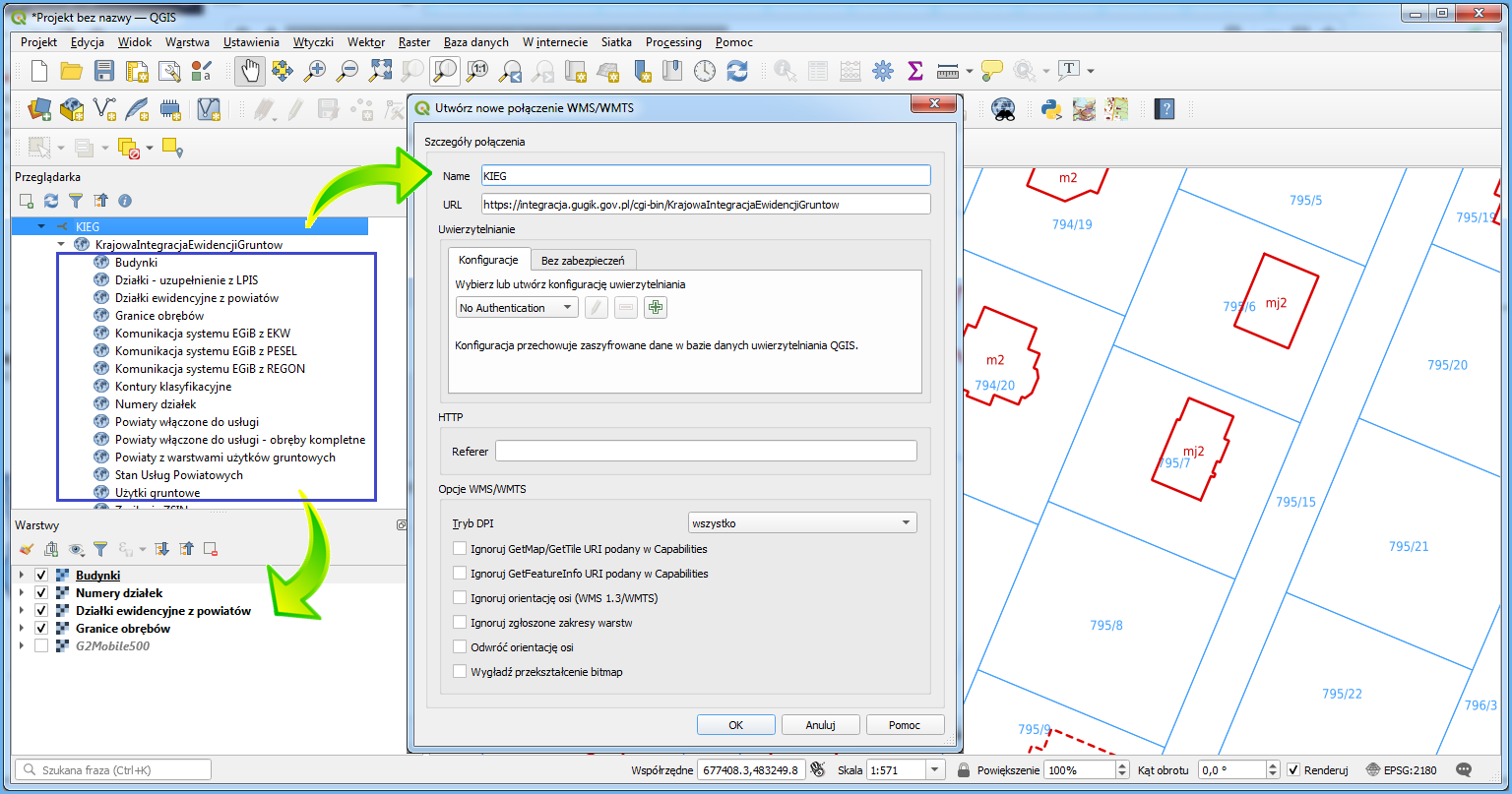
Connected service should display land and building register details for any area of Poland per layer configuration set by the user. The most significant layers include: Cadastral parcels from each county, parcel numbers, buildings, and in the areas for which there are no complete geometric data available, the “Działki – uzupełnienie z LPIS” (Parcels – LPIS supplementary data) layer can be useful. The service also provides the classification contour and usable land layers but, at the moment, not all the counties provide access to this data.
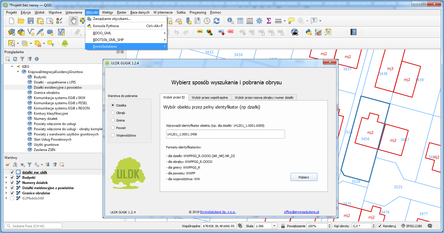
The best solution for searching parcels is to install a plug-in by EnviroSolutions Sp. z o. o. which uses the ULDK to find any parcel.
Generally, data from the Land and Building Register is made available in return for payment, but some part of it, i.e. geometry of cadastral parcels and buildings, along with basic attributes is available free of charge for any purpose. This data can be downloaded using WFS web services of respective counties which are intended for downloading vector data based on user-defined criteria. GML format is used for data transfer.
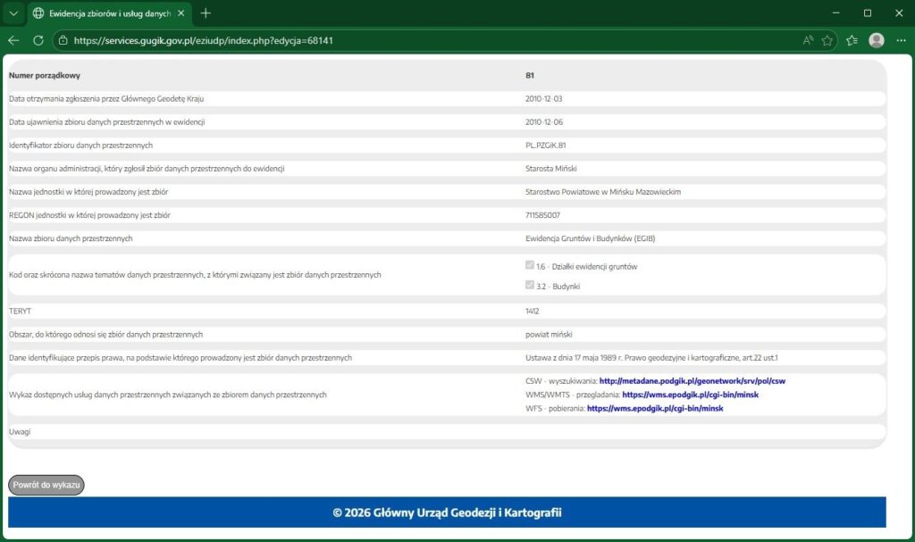
Information about counties that share the WFS service can be found in the Register of Collections and Services on www.geoportal.gov.pl, tab “Registers“.
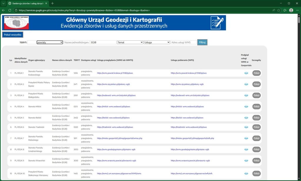
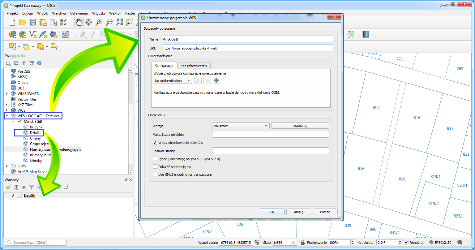
If the respective county offers WFS downloading, you can download its address from the list by clicking “Pokaż” (Show) to access detailed data for the collection and to copy a WFS address that may be available.
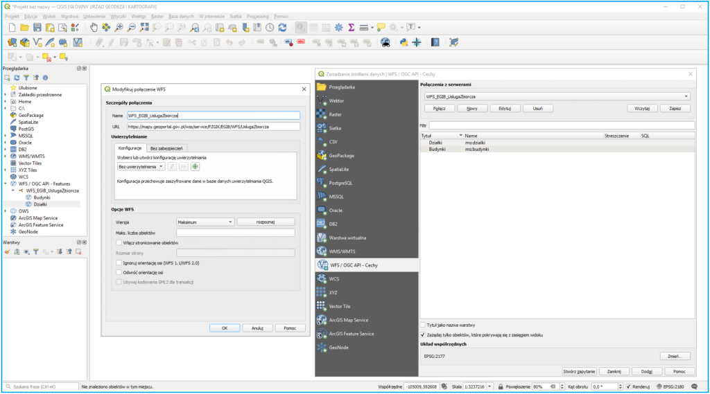
Then, based on such service, define a data source in QGIS to create an information layer of the shared data in a QGIS project at any time.
When the layer is created in a QGIS project, the service generates an image of cadastral parcels for the browsed area. Use the export option illustrated below to save the on-screen piece of data as a file.
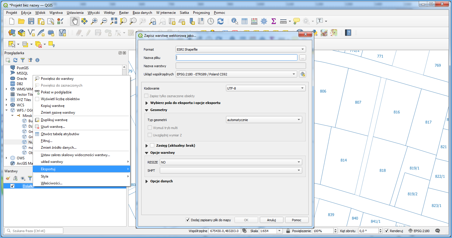
As a result, you get a local file consistent with the settings which represents the respective fragment of cadastral parcels from the county. This way, you conveniently download required data from the county database without submitting any requests or involving employees of the county authorities.
The Surveyor General of Poland provides tools that enable downloading parcel and building data in vector format for the entire country, based on county-level download services (WFS) registered in the register of spatial data sets and services. Information on parcels and buildings for the entire country can be obtained through:
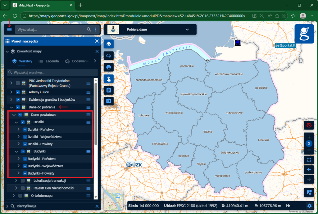
- The “Download Data” module available on the geoportal.gov.pl website, in the section “Download Data” > “County Data”. This functionality enables quick and convenient downloading of cadastral parcel and building data for the entire country, a selected voivodeship, or a county in geoparquet and gpkg formats. Detailed information about the new “County Data” service is available in the following publications on the geoportal.gov.pl website:
• The new “County Data” service available on the www.geoportal.gov.pl
• Buildings from EGiB available for download on the www.geoportal.gov.pl
- A combined integration download service (WFS) that aggregates data from 385 download services (WFS) registered in the register of spatial data sets and services for the dataset called “Land and Building Register (EGiB)”. The service is available at: https://mapy.geoportal.gov.pl/wss/service/PZGIK/EGIB/WFS/UslugaZbiorcza.
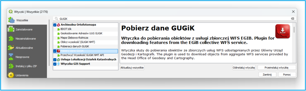
A plugin available in the QGIS repository called “Download GUGiK Data”, provided by the Head Office of Geodesy and Cartography (GUGiK). Explanations regarding the mechanism of operation of this plugin are included in the following publications on the geoportal.gov.pl website:
• GUGiK provides a plugin for downloading data directly into QGIS software;
• GUGiK provides an update to the plugin for downloading data directly into QGIS software.