The National Register of Geographical Names (PRNG) is an official reference database that provides the basis for other spatial information systems that use geographic nomenclature data. The PRNG consists of two parts, including:
- names of geographic objects and features located entirely or partially within the territory of the Republic of Poland, including maritime areas of the Republic of Poland and maritime administration;
- names of geographic objects and features located outside the territory of the Republic of Poland in the Polish language.
The PRNG covering geographical names from the territory of Poland contains data on official, standardized and non-standardized names of geographical objects and features (names of towns/cities and physiographic features) along with their attributes, including detailed information on the name itself and the described object or feature. In turn, the register of Polish geographical names for objects and features around the world contains standardized names adopted and recommended for use by the Commission on Standardization of Geographical Names Outside the Republic of Poland. All objects and features (names) collected in the PRNG database include a spatial reference (geographic coordinates).
The PRNG database is updated on an ongoing basis, based on legal acts, data, and documents concerning geographical nomenclature. The official nomenclature is verified each year as at 1 January pursuant to the provisions issued under Article 7(1) of the Act of 29 August 2003 on official names of localities and physiographic objects.
The legal basis for creating, updating, verifying and sharing data, as well as for the scope of information collected in the PRNG database is the Regulation of the Minister of Development, Labour and Technology of 29 January 2021 on the National Register of Geographical Names (Journal of Laws of 2021, item 273).
The cartographic image of the PRNG database is used at www.geoportal.gov.pl in line with user requirements (Fig. 1).

PRNG data can be browsed via WMS which is by default connected to www.geoportal.gov.pl. However, this service can also be connected to any software that supports such standard:
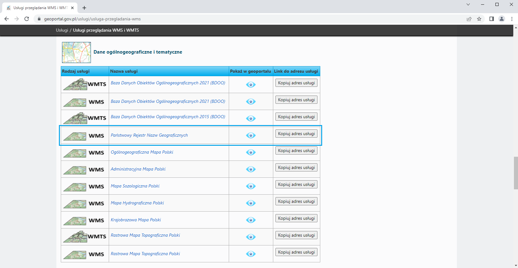
Information on the aforementioned service managed by the Head Office of Geodesy and Cartography can be found in the main menu of www.geoportal.gov.pl under tab „Services / View services (WMS and WMTS)”, as illustrated in Fig. 2.
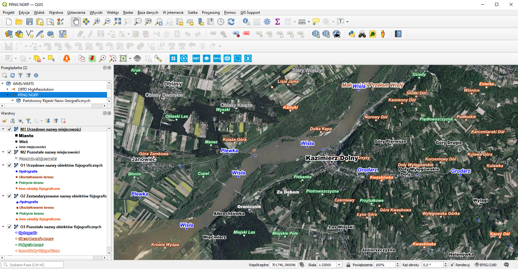
The application of the PRNG browsing functionality in QGIS is shown in Fig. 3.
PRNG data is provided free of charge and can be used for any purpose. There are two ways to download data from www.geoportal.gov.pl.
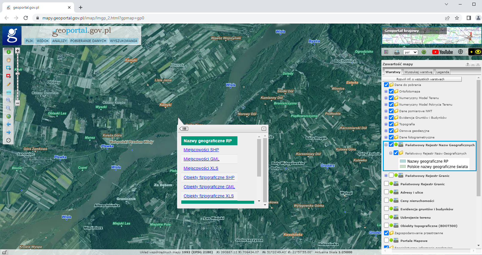
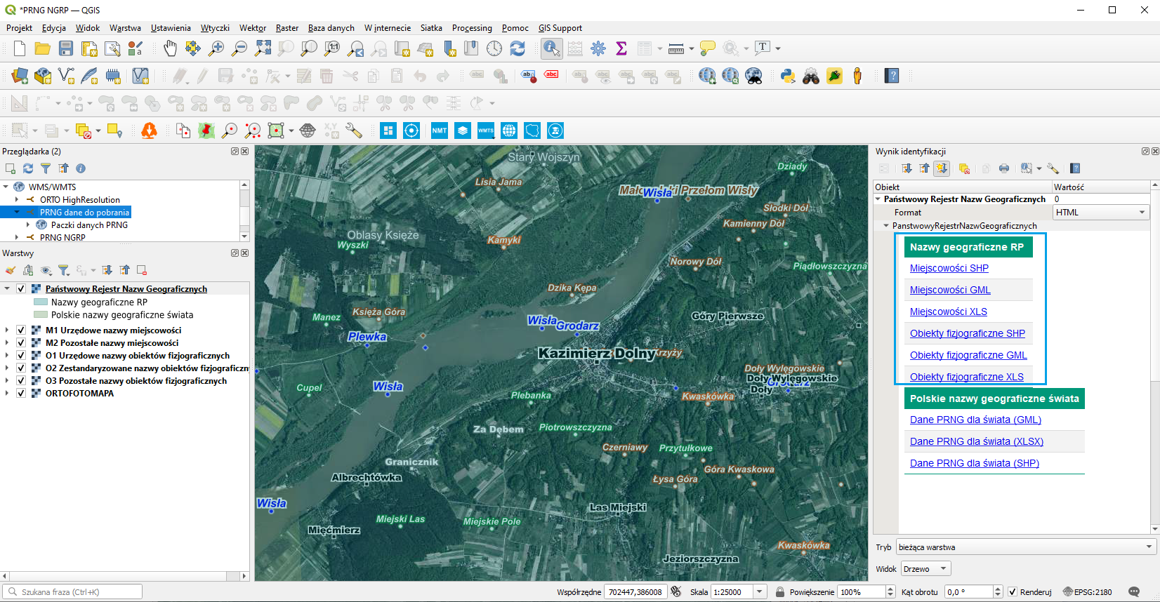
It can be downloaded from the layer tree, specifically by clicking layer “National register of geographic names” under “Data for download“. Enable this layer and click any area of Poland to download the data for the whole country, including details of localities and details of physiographic features separately in GML, SHP, and XLSX format (Fig. 4).
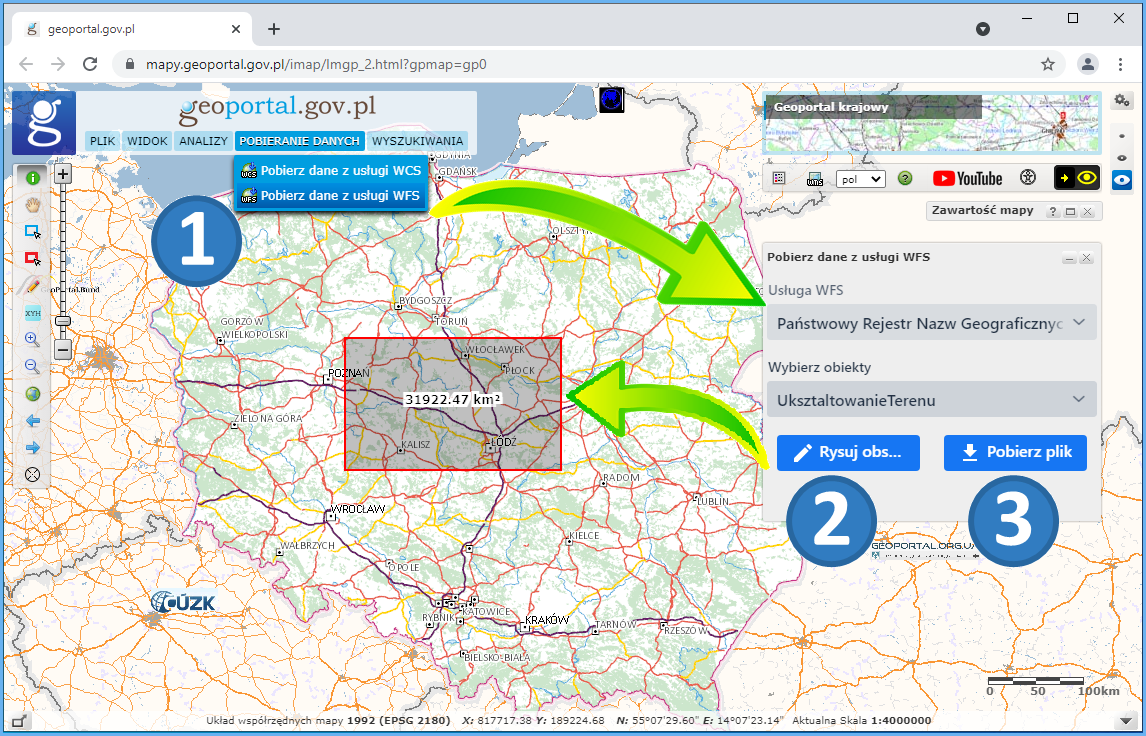
Alternatively, you can download the data by going to the service menu and choosing „DOWNLOAD DATA”. Then select „Pobierz dane z usługi WFS” (Download data via WFS) to download vector data. If you choose WFS, proceed as follows:
- Select “Państwowy Rejestr Nazw Geograficznych” (National Register of Geographical Names), and then select the objects or features to download;
- Draw a rectangular box to select the area of interest;
- Download data file (Fig. 5).
PRNG data at www.geoportal.gov.pl are downloaded via WMS:
https://mapy.geoportal.gov.pl/wss/service/PZGIK/PRNG/WMS/DaneDoPobrania
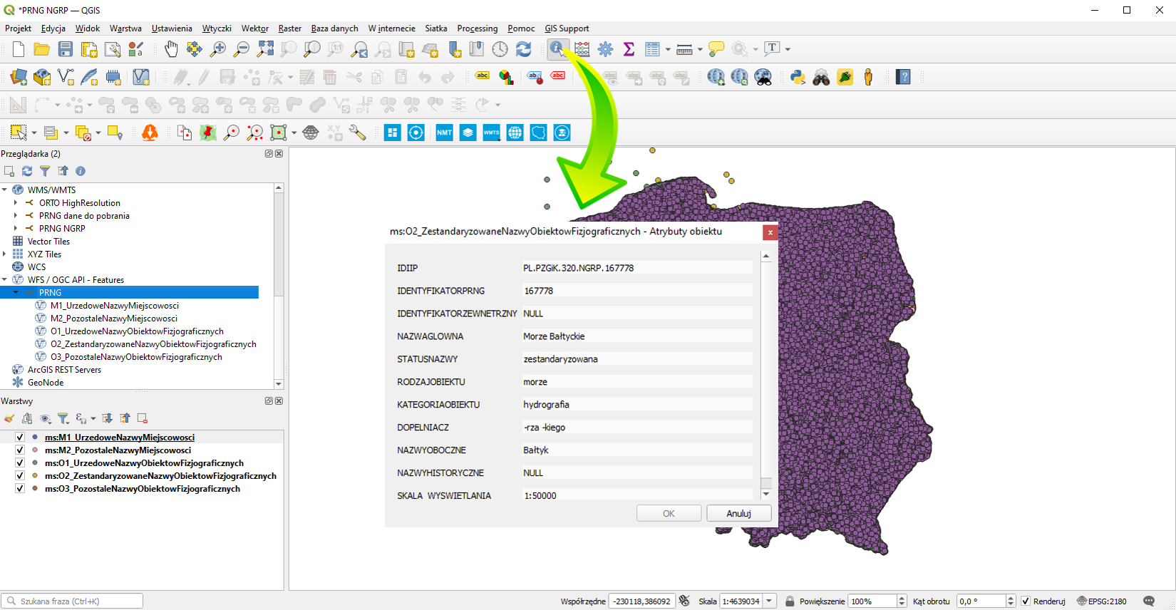
a Specifically, the GetFeatureInfo feature is used for this. It shares PRNG Register data files for download as an attribute in the clicked location. If you connect this service to any software that supports the WMS standard (e.g. QGIS), you can download PRNG data directly in such software (Fig. 6).
Another service related to the PRNG is the Web Feature Service (WFS) which is intended for downloading vector data based on user-defined criteria. GML format is used for data transfer. To access the service, go to: https://mapy.geoportal.gov.pl/wss/service/PZGiK/PRNG/WFS/GeographicalNames.
The image below shows how to define a data source from the specified WFS in QGIS to conveniently add data from this service as a layer in any QGIS project at any time.
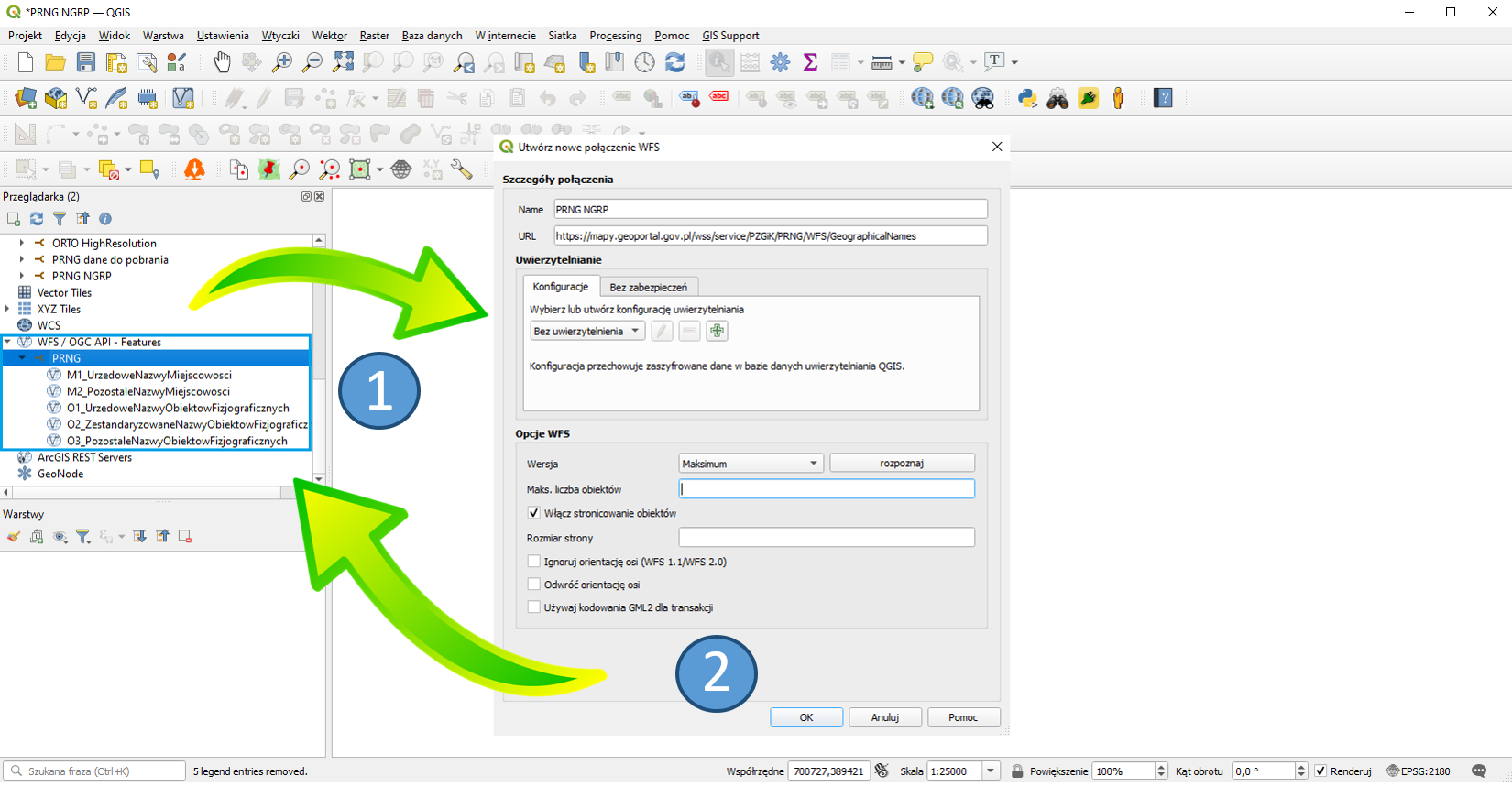
Steps illustrated in Fig. 7 allow you to define a WFS-based PRNG data source which provides details from the PRNG illustrated in Fig. 8 for use.
Drag the selected data to the project legend to create a thematic layer in QGIS from the displayed data.
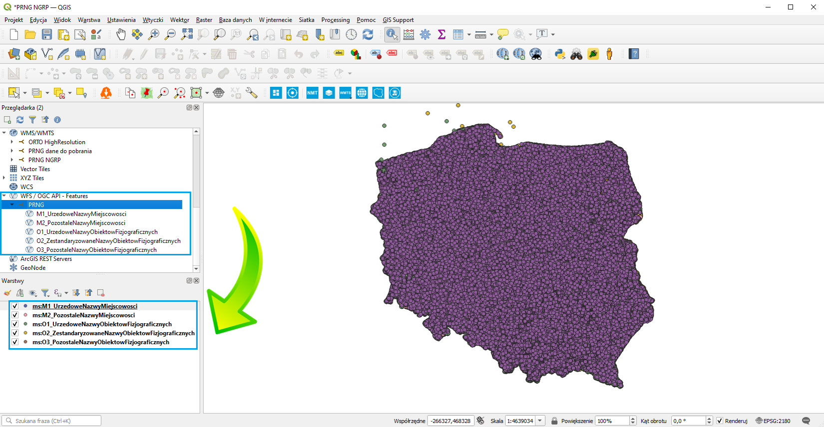
Data connected via WFS are automatically downloaded to your computer, and QGIS has access to all the offered attributes, as illustrated in Fig. 9.
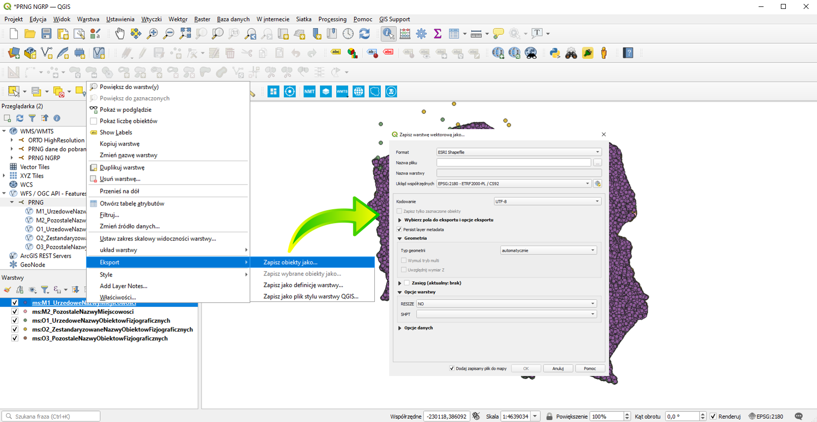
If you want to save the data of the information layer to an external file, use the standard export functionality which can be found at each information layer in QGIS (Fig. 10). It allows you to save data in various formats, depending on the layer type.