The orthophotomap represents a raster Earth surface image created by processing aerial or satellite images. Pursuant to the Geodetic and cartographic law act, the person responsible for the maintenance of the orthophotomap database in Poland is the Surveyor General of Poland. At the moment, the most accurate orthophotomaps available in the National Geodetic and Cartographic Resources (NGCR) represent the area of 3 cm × 3 cm in a single pixel of image.
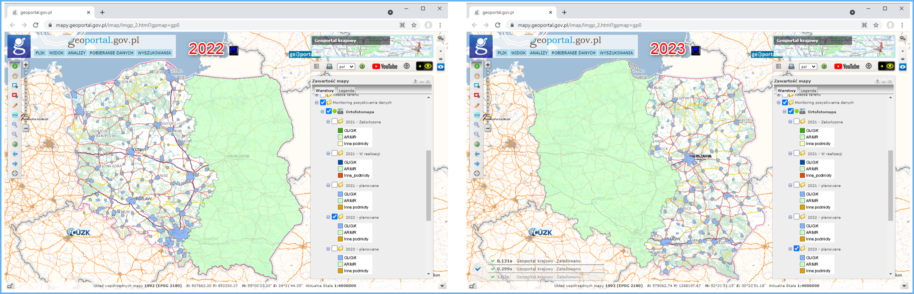
Most of the orthophotomap available in the NGCR reflects the 25 × 25 cm standard, and for urban areas – 10 × 10 cm or less. Plans assume that an orthophotomap with a pixel of 25 cm is prepared every two years, and for county cities, an orthophotomap with a pixel of 5/10 cm is also be prepared every two years but with a shift of a year in relation to the former map. As a result, the area of each larger city will be updated every year by an orthophotomap with a pixel of either 25 cm or 5/10 cm. For detailed and up-to-date information on planned orthophotomap processing for years 2021, 2022, and 2023, see www.geoportal.gov.pl, layer group „Data acquisition status” (Fig. 2).
At www.geoportal.gov.pl, you can also find an actual orthophotomap (so-called true ortho) which is geometrically different from a standard orthophotomap, because it eliminates radial offsets of objects that protrude above the ground level (e.g. buildings) or the “dead spots” which are the areas covered by inclined protruding objects. It means that both objects on the ground surface (e.g. building basements) and objects that protrude and conceal the ground surface (e.g. roof edges) are presented as an orthogonal projection. The Digital Surface Model is used to eliminate radial offsets.

Orthophotomap data browsing services
Orthophotomap data can be browsed using WMS and WMTS which are by default connected to www.geoportal.gov.pl. However, these services can also be connected to any software that supports such standards.
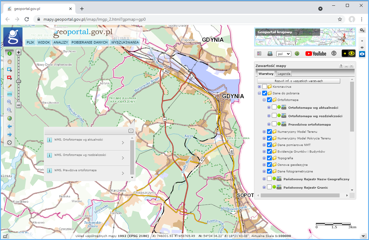
Information on all services related to the orthophotomap managed by the Head Office of Geodesy and Cartography can be found in the main menu of www.geoportal.gov.pl under tab „Services / View services (WMS and WMTS)” (Fig. 4).
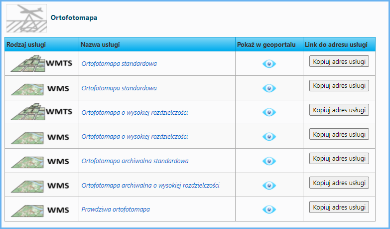
In terms of the orthophotomap, WMS and WMTS are key services to display the standard orthophotomap:
- https://mapy.geoportal.gov.pl/wss/service/PZGIK/ORTO/WMS/StandardResolution
- https://mapy.geoportal.gov.pl/wss/service/PZGIK/ORTO/WMTS/StandardResolution
WMS and WMTS for the high-resolution orthophotomap:
- https://mapy.geoportal.gov.pl/wss/service/PZGIK/ORTO/WMS/HighResolution
- https://mapy.geoportal.gov.pl/wss/service/PZGIK/ORTO/WMTS/HighResolution.
and a service for the true orthophotomap:
Moreover, there is a WMS for the standard and high-resolution orthophotomap which allows users to view an archived orthophotomap.
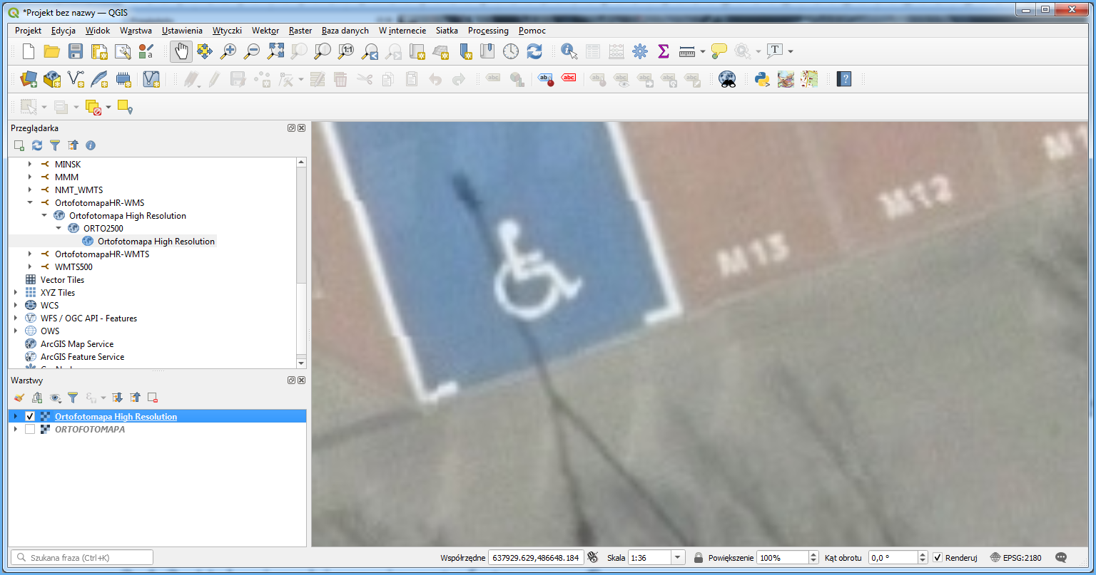
Fig. 5 shows WMTS for the high-resolution orthophotomap connected to QGIS.
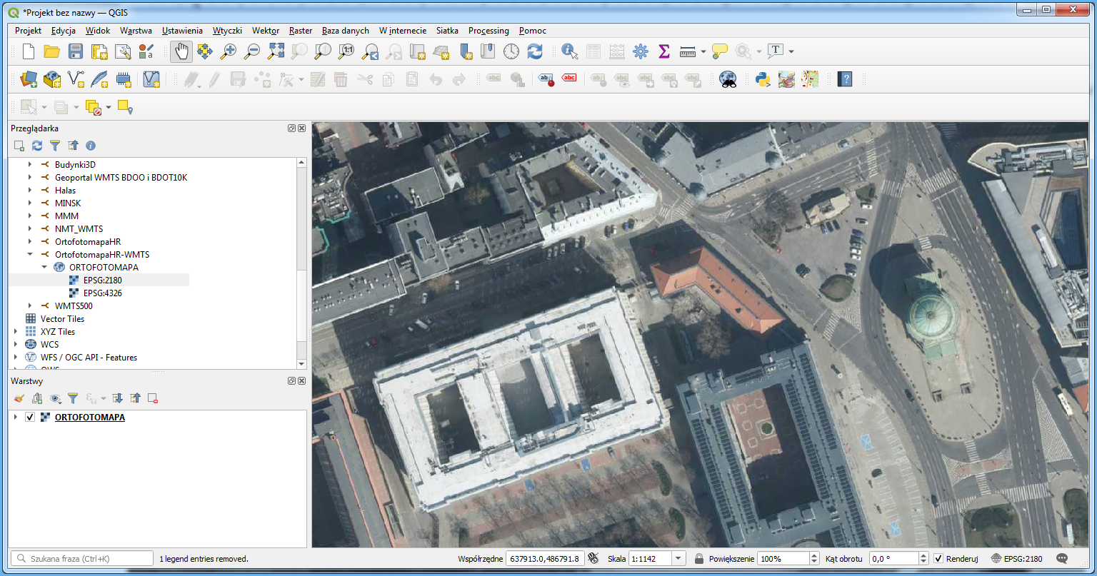
Because WMTS uses prepared tiles adjusted to the 1:250 scale, at higher magnifications, the image can be blurred. If this is the case, try to use WMS as an alternative, because this service uses direct access to original orthophotomap files and generates images based on it.
Availability of the orthophotomap for download
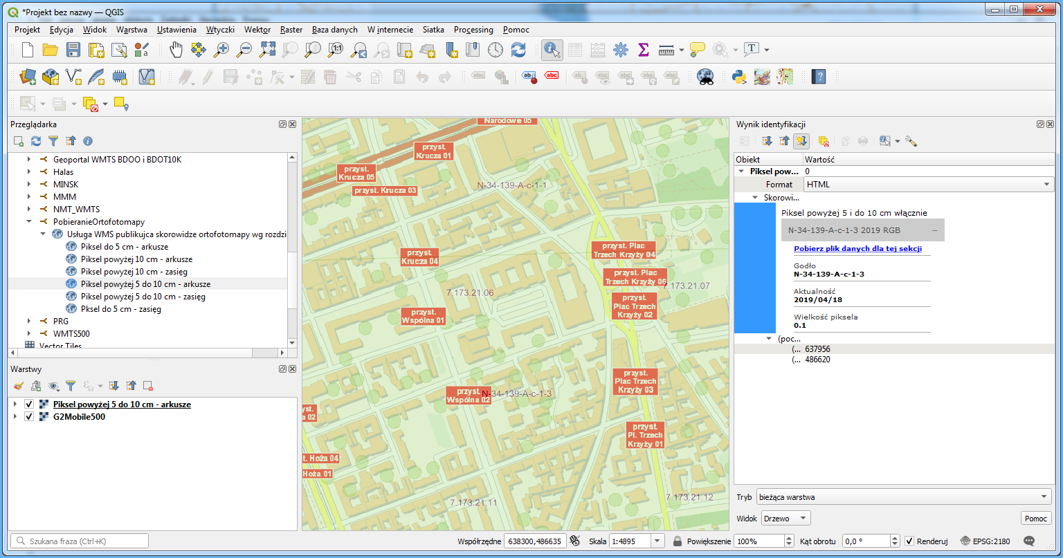
The orthophotomap is provided free of charge and can be used for any purpose. Data can be downloaded from www.geoportal.gov.pl, section “Data for download” layer group “Orthoimagery“, where you can find three layers: “Based on acquisition data“, “Based on pixel size” oraz „True ortho”.
When you enable one of the specified layers and zoom in on the area of interest, you will see rectangles which represent orthophotomap sections. Click the area of interest to display the option to download the relevant orthophotomap file, as shown in Fig. 8.
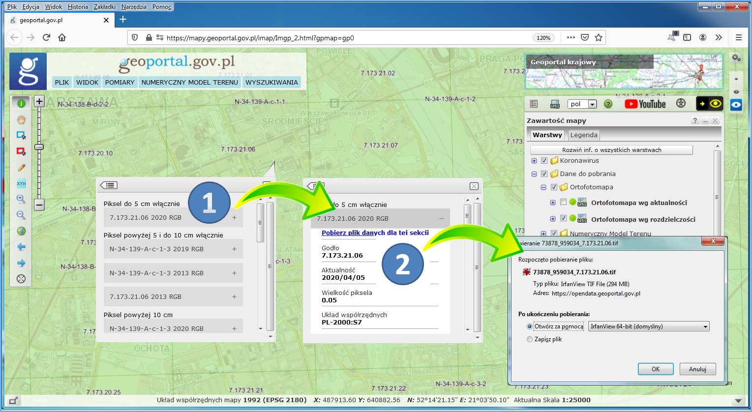
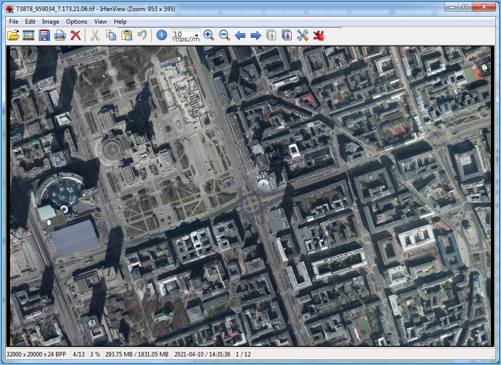
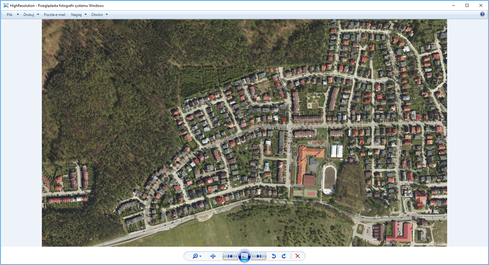
As a result, a file containing the orthophotomap, specifically section 7.173.21.06, will be downloaded to your computer and displayed in the default graphic file browser, as illustrated in Fig. 9.
Orthophotomap details at www.geoportal.gov.pl are downloaded via WMS:
- https://mapy.geoportal.gov.pl/wss/service/PZGIK/ORTO/WMS/SkorowidzeWgAktualnosci
- https://mapy.geoportal.gov.pl/wss/service/PZGIK/ORTO/WMS/SkorowidzeWgRozdzielczosci
Specifically, the GetFeatureInfo feature is used for this. It shares a link to download the relevant orthophotomap file as an attribute in the clicked location. If you connect these services to QGIS or other software, you can use such software to download orthophotomap data directly (Fig. 10).
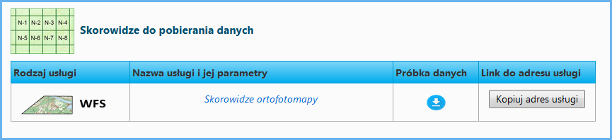
Alternatively, the orthophotomap details can be downloaded via WFS which presents indexes of all the orthophotomaps available in the NGCR by years (from 1957 to 2021). To access the service, go to: https://mapy.geoportal.gov.pl/wss/service/PZGIK/ORTO/WFS/Skorowidze.
You can download orthophotomap indexes using any software that supports a WFS client feature, such as QGIS. You can easily download each orthophotomap sheet from the displayed sheet index. This operation is supported by the “Informacja o obiekcie” (About object) tool. When you click the selected sheet, it will display its metadata, including “Link do pobrania” (Link for download) that you can use to download the orthophotomap.
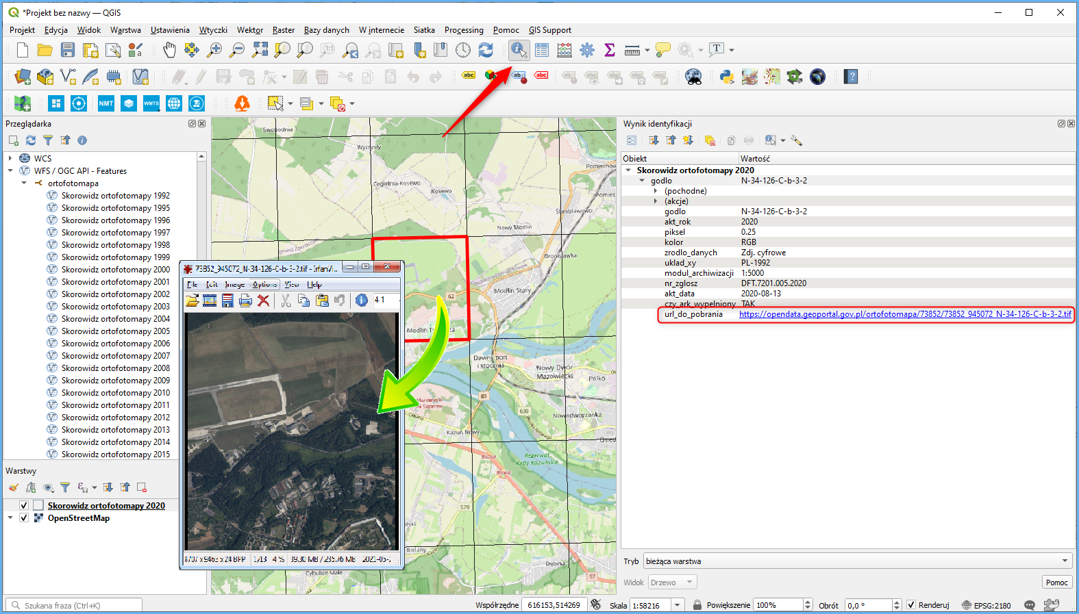
The service makes it easier to download orthophotomaps for larger areas.
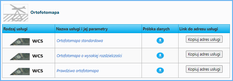
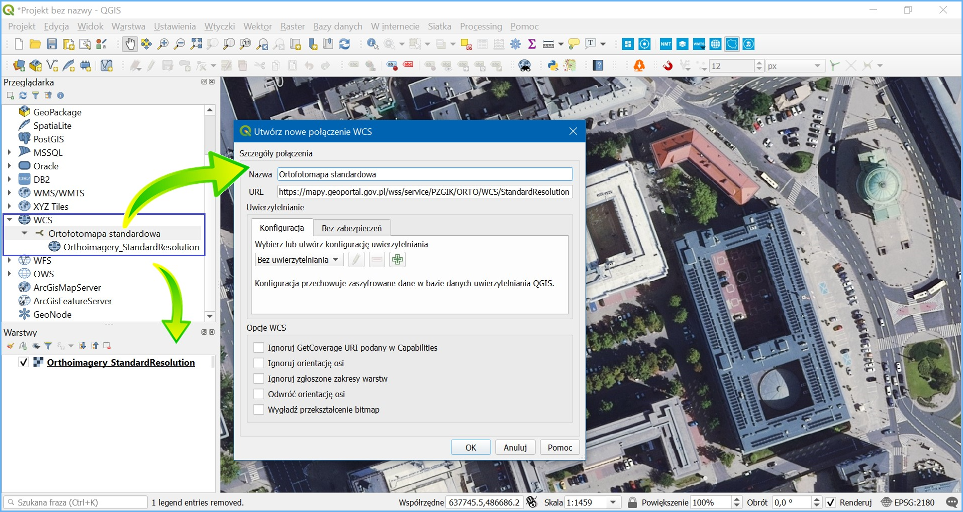
Another way to download the orthophotomap is to use WCS services whose URLs are published on www.geoportal.gov.pl.
The most convenient way to use WCS services is to connect them to QGIS as a data source, as shown in Fig. 14.
When the layer is created in a QGIS project, the service generates an orthophotomap image of the viewed area. Use the export option illustrated below to save a fragment of orthophotomap as a file.
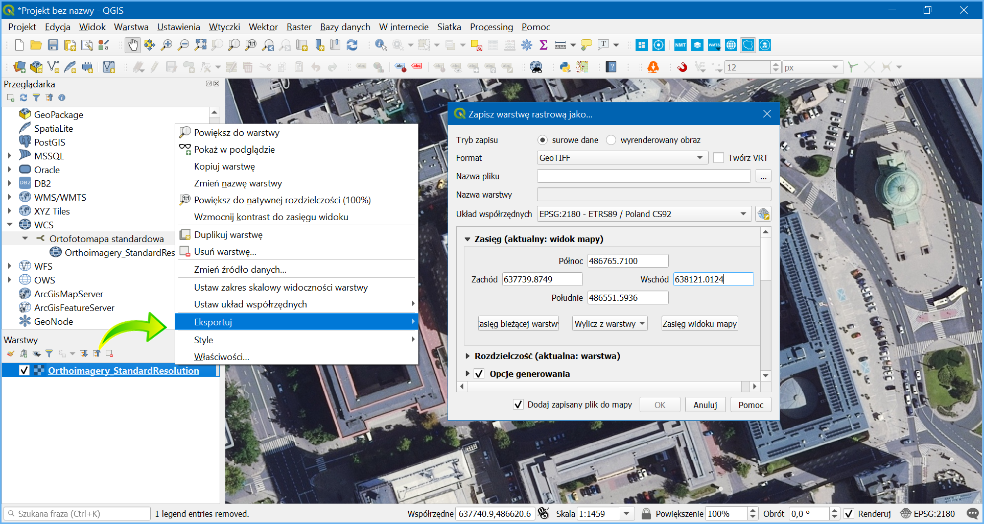
As a result, you get a local file consistent with the settings which represents the respective fragment of a single sheet of the original orthophotomap or an assembly of multiple pieces from various orthophotomap sheets. For technical reasons, the area available for a single download is limited, but the service is suitable for downloading fragments corresponding to around a dozen original orthophotomap sheets.
The orthophotomap can also be downloaded via WCS directly from www.geoportal.gov.pl using the „Pobierz dane z usługi WCS” (Download data from WCS service) tool. You can find this functionality on the toolbar in the left part of the map application user interface, as illustrated below.
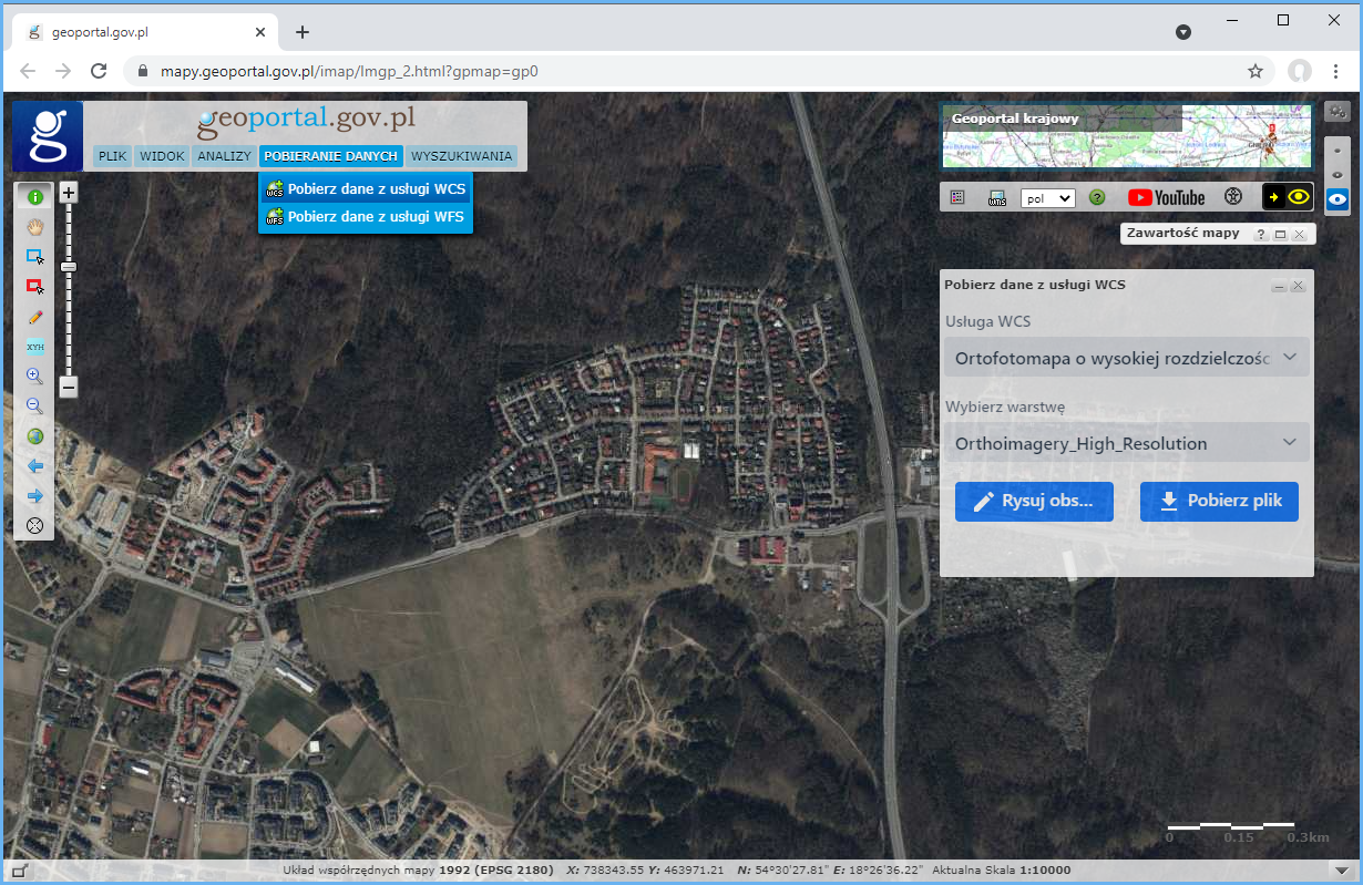
To download data, click the tool icon, select the data for download in the displayed pane or select a spatial range on the map (max. 10 km2), as shown in Fig. 17.
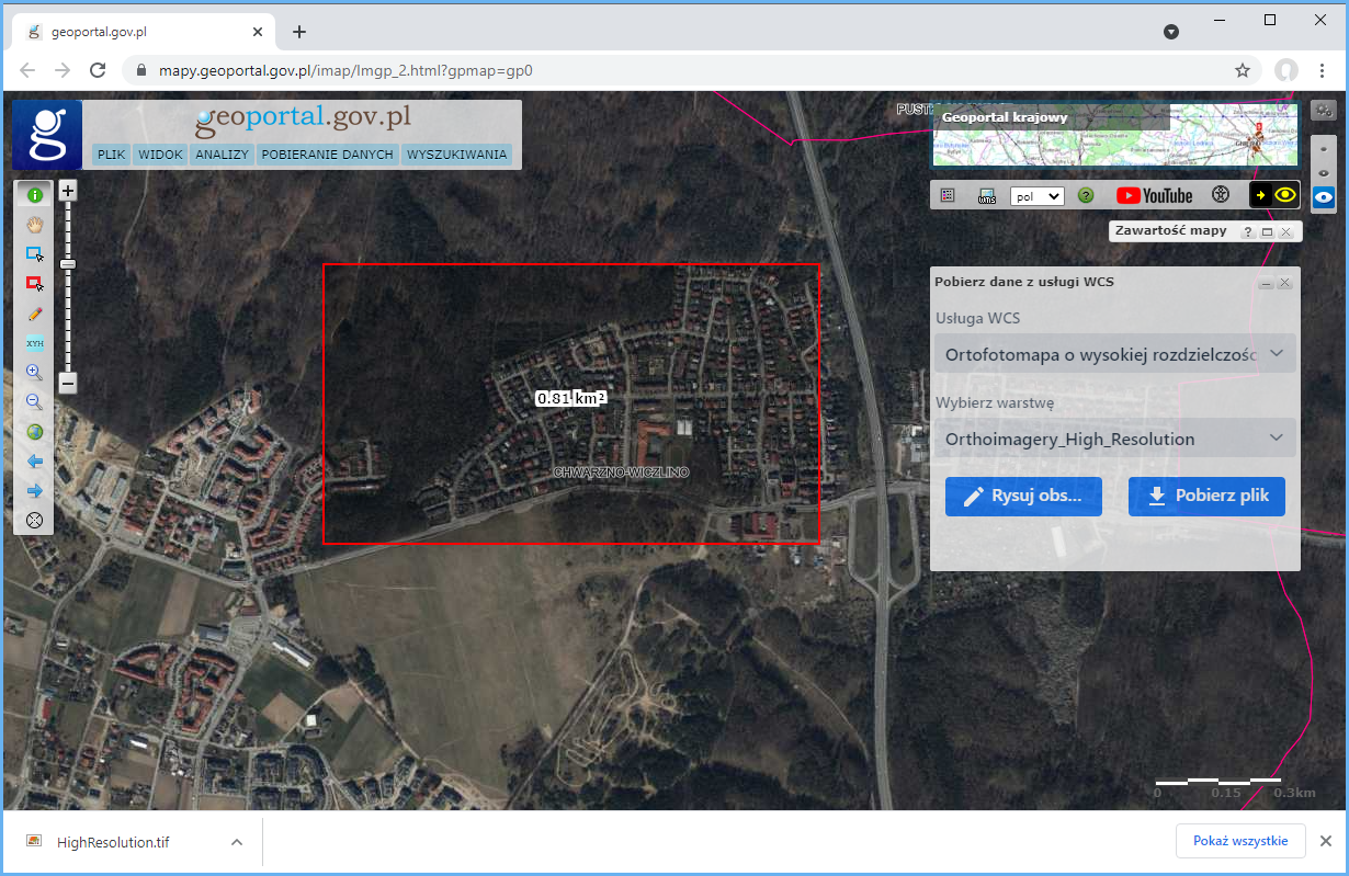
Afterwards, all you have to do is download the prepared data file:
The tool is particularly useful when the area of interest covers e.g. four orthophotomap sheets and, if downloaded in the conventional manner, would yield four sheets that you would have to put together.