The National Register of Boundaries (PRG) is an official reference database that provides the basis for other spatial information systems and uses data concerning administrative units of the country. The PRG covers the area of the whole country and contains information about boundaries and areas of the fundamental three-level administrative division of the country (i.e. communes, counties, and voivodships). In addition to geometric data, each administrative unit is assigned descriptive attributes, such as a unit name or TERYT code.
PRG data is updated every year to reflect the status as at 1 January, pursuant to the legal acts on creation, merging, liquidation, and division of administrative units or changes to their boundaries, or as a result of updates or changes to the Land and Building Registration.
The legal basis for creating, updating, verifying and sharing data, as well as for the scope of information collected in the PRG database is the Regulation of the Council of Ministers of 16 July 2021 on the national register of boundaries and area of administrative units of Poland (Journal of Laws of 2021, item 1373).
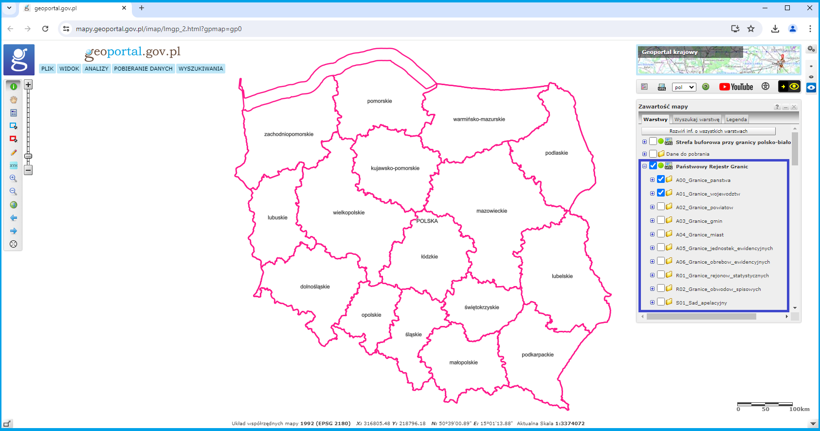
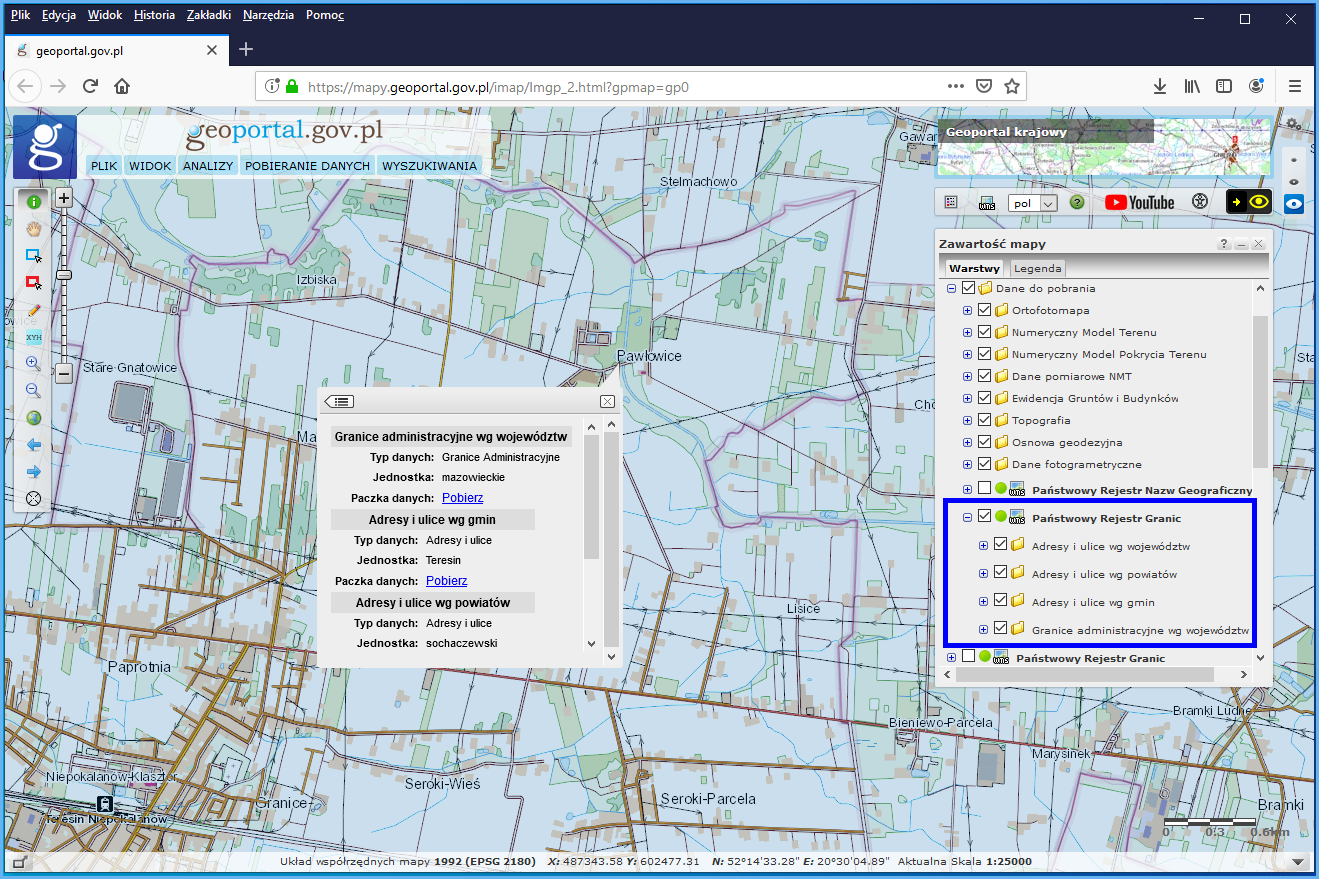
The cartographic image of the PRG database is used at www.geoportal.gov.plin line with user requirements (Fig. 1).
Availability of PRG browsing services
PRG data can be browsed via WMS services which are by default connected to www.geoportal.gov.plHowever, these services can also be connected to any software that supports such standard. The key services in this respect include:
- https://mapy.geoportal.gov.pl/wss/service/PZGIK/PRG/WMS/AdministrativeBoundaries
- https://integracja.gugik.gov.pl/cgi-bin/KrajowaIntegracjaNumeracjiAdresowej
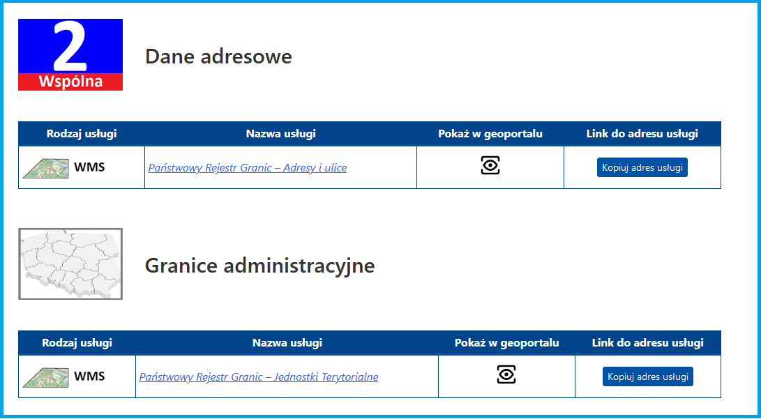
Information on all services related to the PRG managed by the Head Office of Geodesy and Cartography can be found in the main menu of www.geoportal.gov.pl under tab „Services / View services (WMS and WMTS)”, as illustrated in Fig. 2.
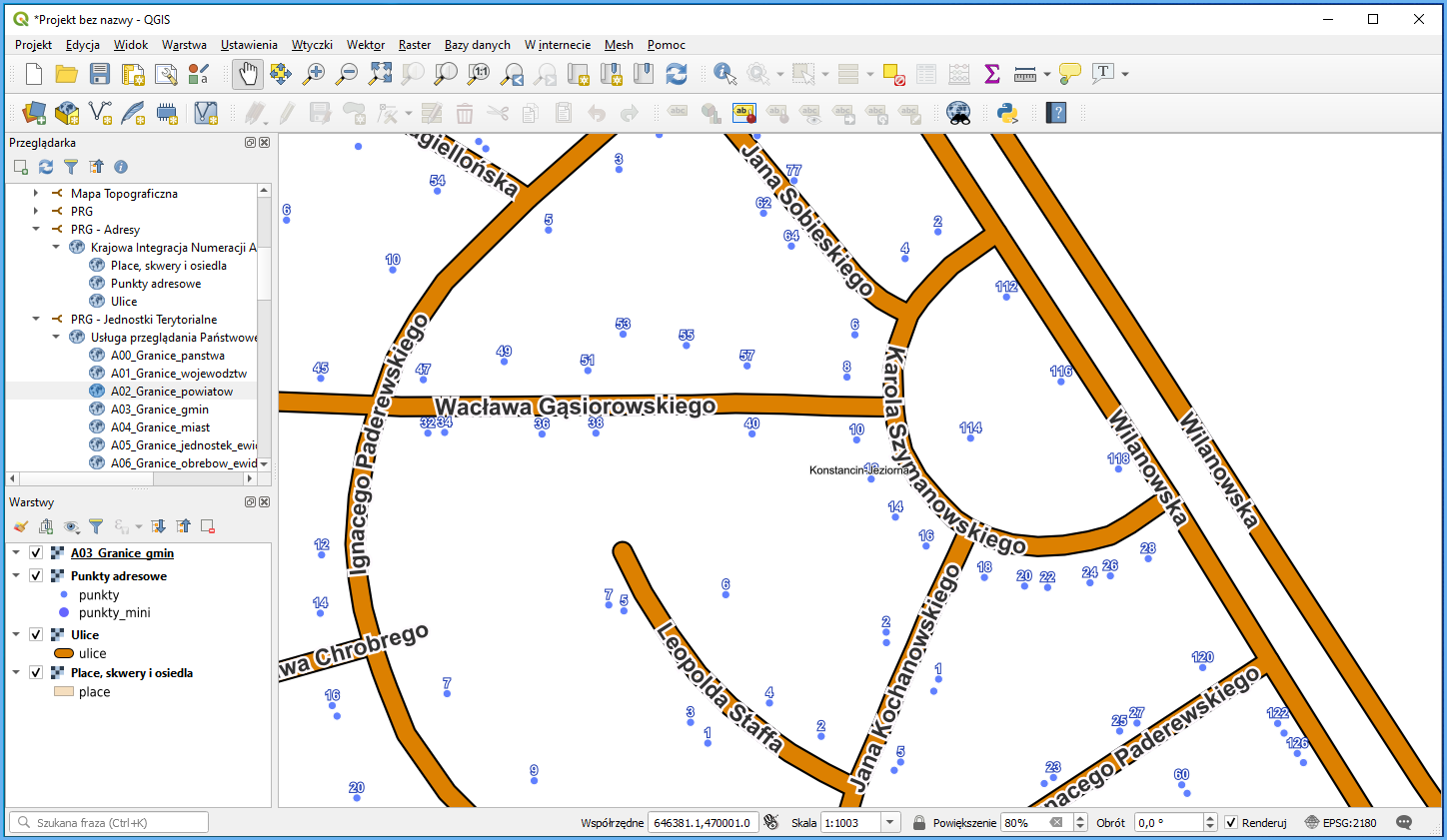
The application of the PRG browsing functionality in QGIS is shown in Fig. 3.
Availability of PRG data for download
PRG data is provided free of charge and can be used for any purpose. There are two ways to download data from www.geoportal.gov.pl jest możliwe na dwa sposoby.
It can be downloaded from the layer tree, specifically by clicking layer „National Register of Boundaries”” under „Data for download”.Turn on this layer and click any area of Poland to access and download the data for the clicked location concerning boundaries of the whole voivodship as well as addresses and streets for communes, counties, and voivodships (Fig. 4).
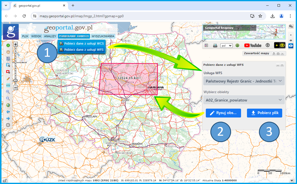
Alternatively, you can download the data by going to the service menu and choosing „DOWNLOAD DATA”. Then select „Pobierz dane z usługi WFS” (Download data via WFS) to download vector data (WFS). If you choose WFS, proceed as follows:
- Select “Państwowy Rejestr Granic – Jednostki Terytorialne” (National Register of Boundaries – Administrative Units), and then select objects or features to download;
- Draw a rectangular box to select the area of interest;
- Download data file (Fig. 5).
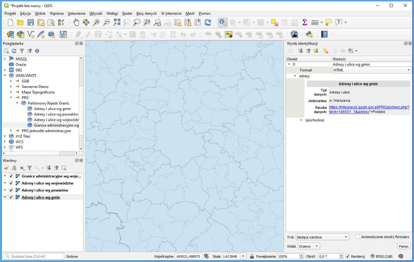
PRG data at www.geoportal.gov.pl is downloaded via WMS: https://integracja.gugik.gov.pl/cgi-bin/PanstwowyRejestrGranic, specifically via the GetFeatureInfofeature which shares the relevant data file from the PRG (i.e. the relevant voivodship package for administrative unit boundaries as well as address packages for communes, counties, and voivodships) for download as an attribute in the clicked location. If you connect this service to any software that supports the WMS standard (e.g. QGIS), you can download PRG data directly in such software (Fig. 6).
Another service related to the PRG is the Web Feature Service (WFS) which is intended for downloading vector data based on user-defined criteria. GML format is used for data transfer. To access the service, go to: https://mapy.geoportal.gov.pl/wss/service/PZGIK/PRG/WFS/AdministrativeBoundaries.
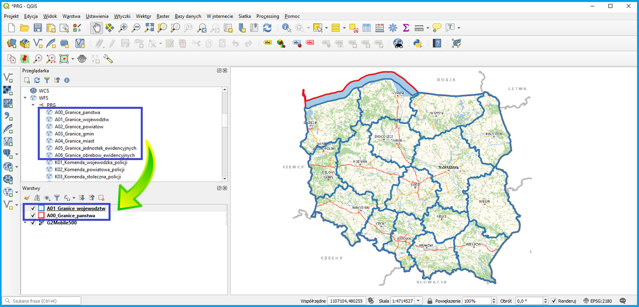
The image below shows how to define a data source from the specified WFS in QGIS to conveniently add data from this service as a layer in any QGIS project at any time.
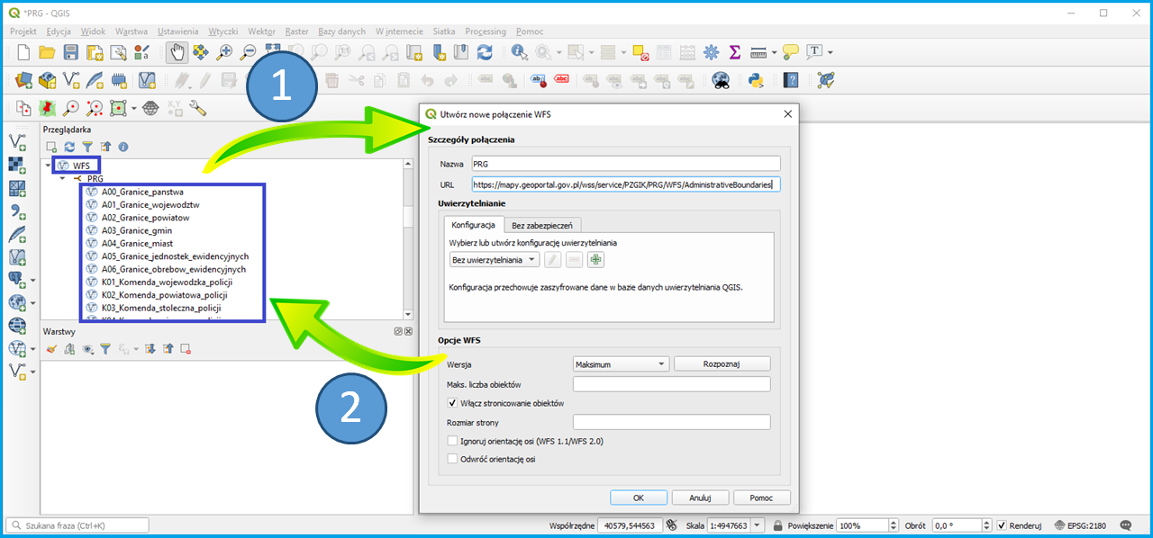
Steps illustrated in the figure above allow you to define a WFS-based PRG data source which provides details from the PRG register for use.
Drag the selected data to the project legend to create a thematic layer in QGIS from the displayed data.
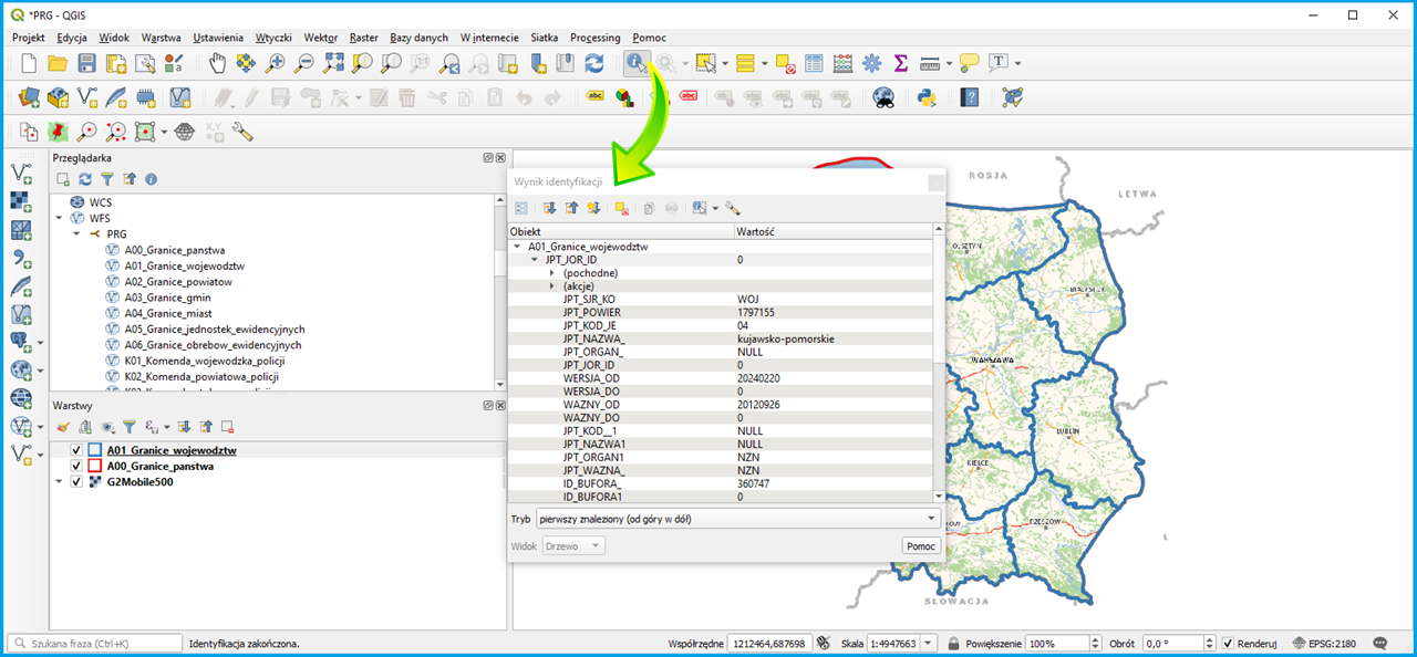
Data connected via WFS is automatically downloaded to your computer, and QGIS has access to all the offered attributes, as illustrated in Figure 9.
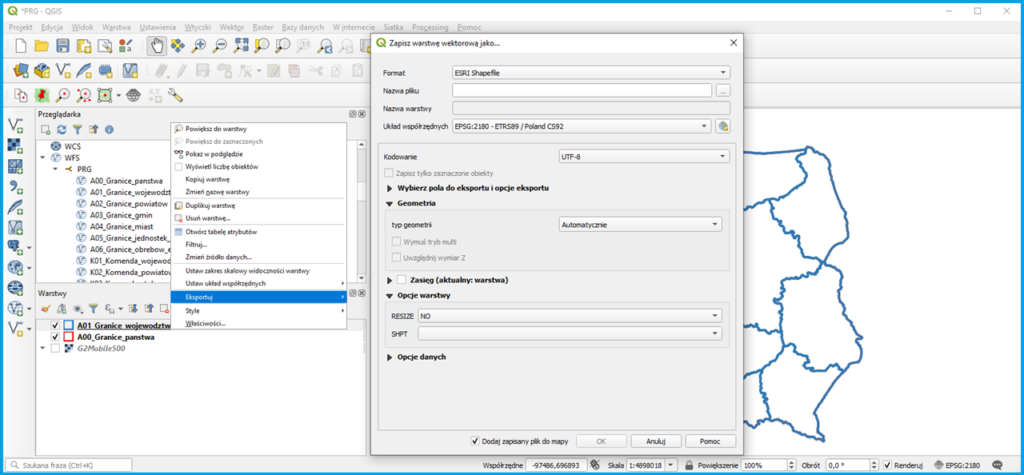
If you want to save the data of the information layer to an external file, use the standard export functionality which can be found at each information layer in QGIS (Fig. 10). It allows you to save data in various formats, depending on the layer type.