3D models of buildings are a three-dimensional representation of a significant part of buildings derived from the BDOT10k database. 3D models of buildings have been constructed from the compilation of three data sources, i.e.:
- a two-dimensional footprint of buildings, from the BUBD_A object class in the BDOT10K database,
- LiDAR Point Cloud Data (building class) obtained in airborne laser scanning technology (density 4 points/m2 and 12 points/m2 or greater – depending on the area type),
- digital terrain model (1 m grid size).
3D models of buildings were developed by the Head Office of Geodesy and Cartography:
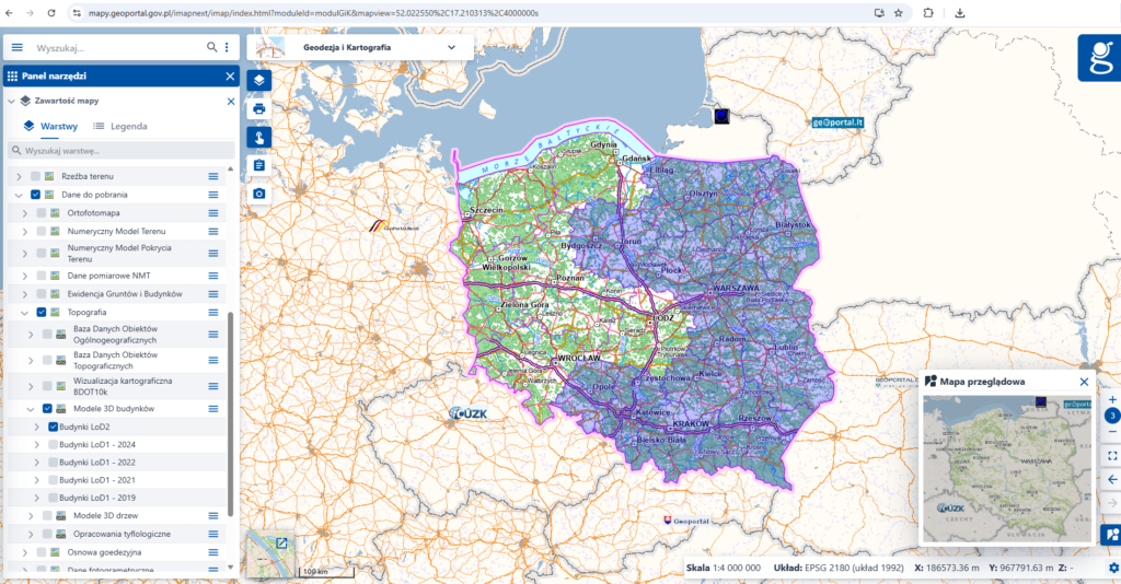
- based on the CityGML 2.0 standard, the LoD2 level of detail, as a part of the task “Construction of 3D models of buildings” in the project of the Center for Spatial Analysis of Public Administration (CAPAP), for 236 counties covering the area of 10 voivodeship (purple):
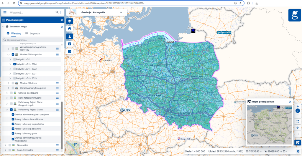
2. based on the CityGML 2.0 standard, the LoD1 level of detail, as a part of internal works for the entire country (fig.2); the LoD1 level of detail for the presentation of buildings uses solids with a base corresponding to a two-dimensional footprint of building from the BUBD_A object class in the BDOT10K database and the height obtained from LiDAR Point Cloud Data (building class), as a median of points in the building outline.
3D models of buildings are available in five layers:
- Buildings LoD2 – developed as of 2018
- Buildings LOD1 2019 – developed on the basis of source data available in the central geodetic and cartographic resource as of 2018/2019
- Buildings LOD1 2021 – developed on the basis of source data available in the central geodetic and cartographic resource as of 2021
- Buildings LOD1 2022 – developed on the basis of source data available in the central geodetic and cartographic resource as of 2022
- Buildings LOD1 2024 – developed on the basis of source data available in the central geodetic and cartographic resource as of 2024.
3D models of buildings in the LoD1 standard are available in county packages and have been generated automatically on the basis of current data available in the state geodetic and cartographic resource, with the following assumptions:
- the height of the ground surface was calculated as the height of the lowest point of the building, determined from the intersection of the building footprint from the BDOT10k Database of Topographic Objects (BUD_A class) with the Digital Elevation Model (DEM) in the PL – EVRF2007-NH height system
- the height of rooftop surface is determined from the median of the height calculated from LIDAR Point Cloud Data (building class) as the median of points in range of the building ground surface
- the type of building geometry is represented as a Solid, a flat roof
- every 3D model of building has the following attributes:
- BDOT10k object identifier (buildingId),
- namespace of the BDOT10k object (przestNazw)
- BDOT10k object version (wersjaId)
- roof geometric data source (zrodloDach):
- ALS_I – when using ALS data with a density of 4 points/m2 or 6 points/m2
- ALS_II – when using ALS data with a density of 12 points/m2 or more
- timeliness of roof geometric data from the ALS point cloud (aktZrodla)
- roof type 1000 – flat roof (bldg:roofType)
3D models of buildings developed on the basis of source data available in the central geodetic and cartographic resource as of 2024 additionally have an attribute of approximate height (measuredHeight).
Viewing 3D models of building
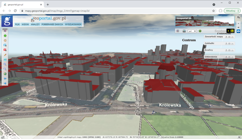
All 3D models of buildings in the LoD1 and LoD2 standards can be viewed in the Geoportal 3D.
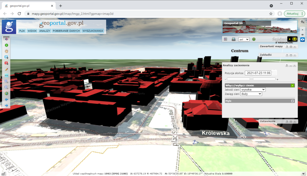
If you zoom to the area of interest, you can view the 3D models of buildings from different perspectives (see figure below).
In addition to viewing 3D models of buildings, you can also perform simple shading analyzes using the available function „Shading analysis”:
Availability of 3D models of buildings for download
3D models of buildings are available free of charge and free to use. Downloading data is possible from the www.geoportal.gov.pl website, where in the “Data for download” section you can see a group of layers “Topography” -> 3D Models of buildings” and there in turn, five layers:
- Buildings LoD2
- Buildings LoD1 – 2019
- Buildings LoD1 – 2021
- Buildings LoD1 – 2022
- Buildings LoD1 – 2024
Using the identification tool, click on the map within the boundaries of the district for which you want to obtain data. As a result there is displayed a list of available layers (see figure below). Then, from this list, select “3D Models of buildings“.
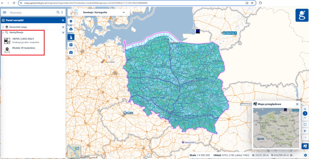
In the information window (see figure below), there are appeared information of the selected district and also a link to download the 3D models of buildings.
To display and process data, you can use e.g. free of charge QGIS software and also instructional videos, that can be found at channel Youube GUGIK.
If you have any questions please contact the Photogrammetry Department of the Head Office of Geodesy and Cartography, that is responsible for development of the 3D models of buildings, phone: (22) 56 31 374, e-mail: foto@gugik.gov.pl