Numeryczny model pokrycia terenu (NMPT) stanowi reprezentację powierzchni terenu wraz z obiektami wystającymi ponad tę powierzchnię, takimi jak: budynki, drzewa, mosty, wiadukty i inne elementy infrastruktury. W Polsce posiadamy i aktualizujemy NMPT w siatce 0,5×0,5m na ternach miejskich i w siatce 1,0×1,0m na pozostałym obszarze.
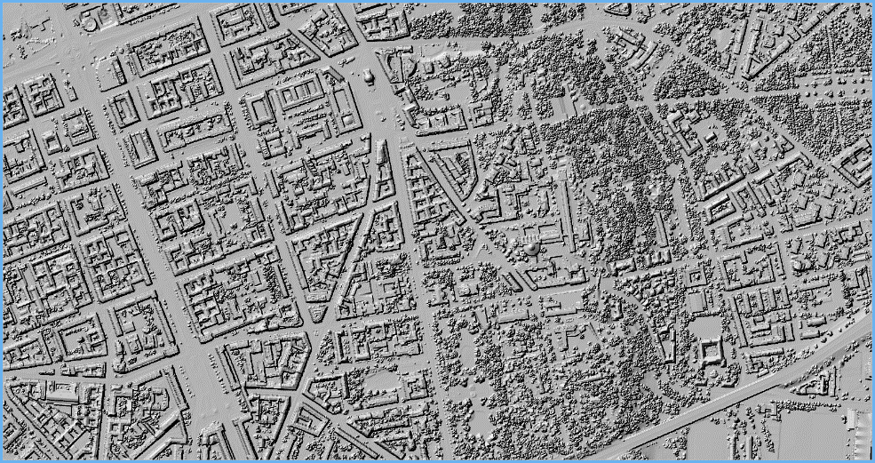
Aktualnie nie ma udostępnionych żadnych usług przeglądania związanych z NMPT, więc aby uzyskać wizualizację NMPT, należy ją wykonać samodzielnie na podstawie pobranych danych źródłowych, np. w oprogramowaniu QGIS.
Usługi pobierania NMPT
Dane NMPT są dostępne bezpłatnie i możliwe do dowolnego wykorzystania. Pobieranie danych jest możliwe z serwisu www.geoportal.gov.pl, w którym w sekcji „Dane do pobrania” widoczna jest grupa warstwa „Numeryczny Model Pokrycia Terenu„, a tam z kolei dwie warstwy „NMPT-PL-KRON86-NH” oraz druga „NMPT-PL-EVRF2007-NH„.
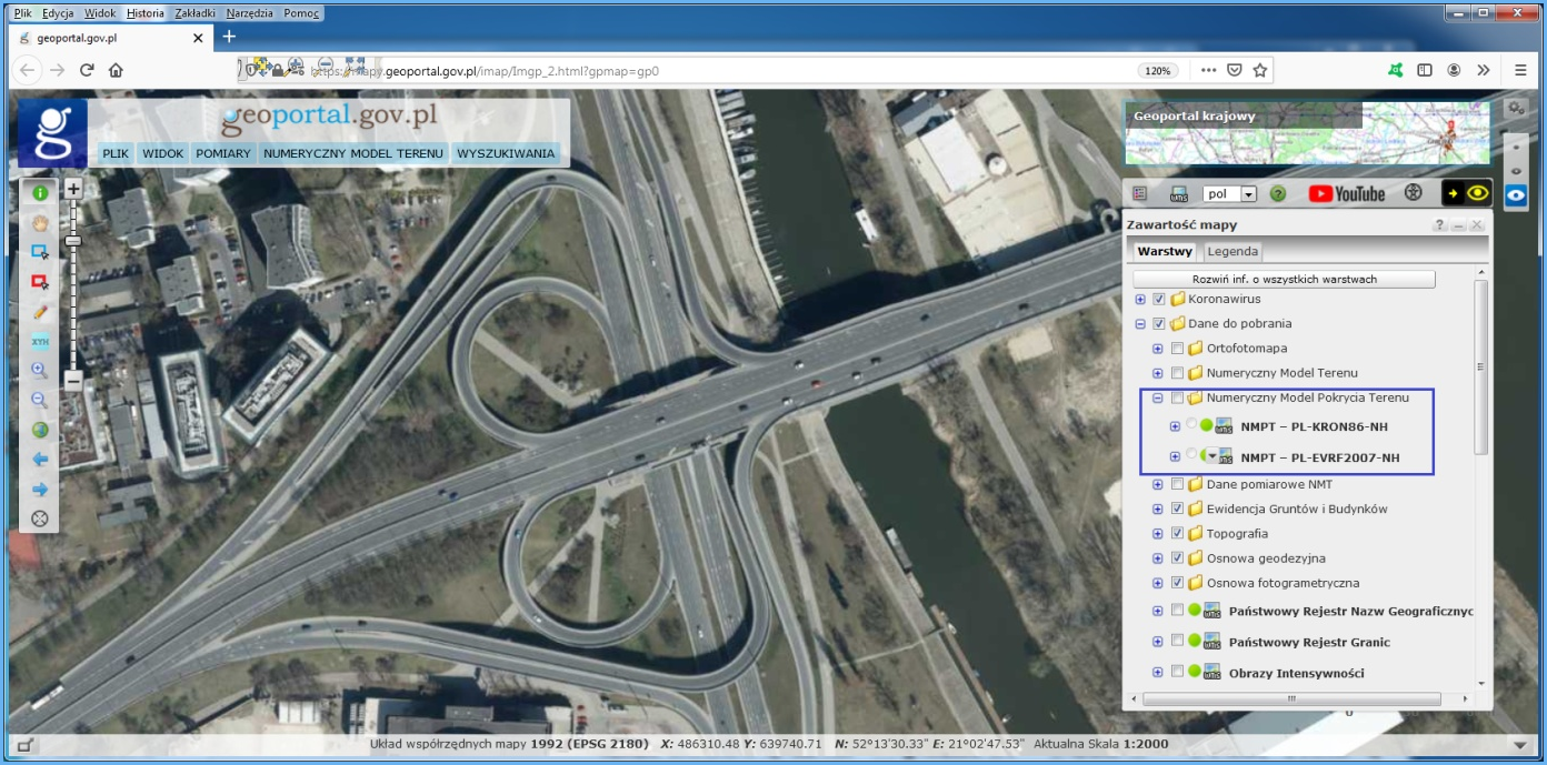
Po włączeniu jednej w wymienionych warstw i przybliżeniu się do miejsca zainteresowania widoczne będą prostokąty obrazujące sekcje z danymi NMPT. Wtedy należy kliknąć w obszarze zainteresowania i na ekranie pojawi się możliwość pobrania odpowiedniego pliku, co zilustrowano na rys. 3.
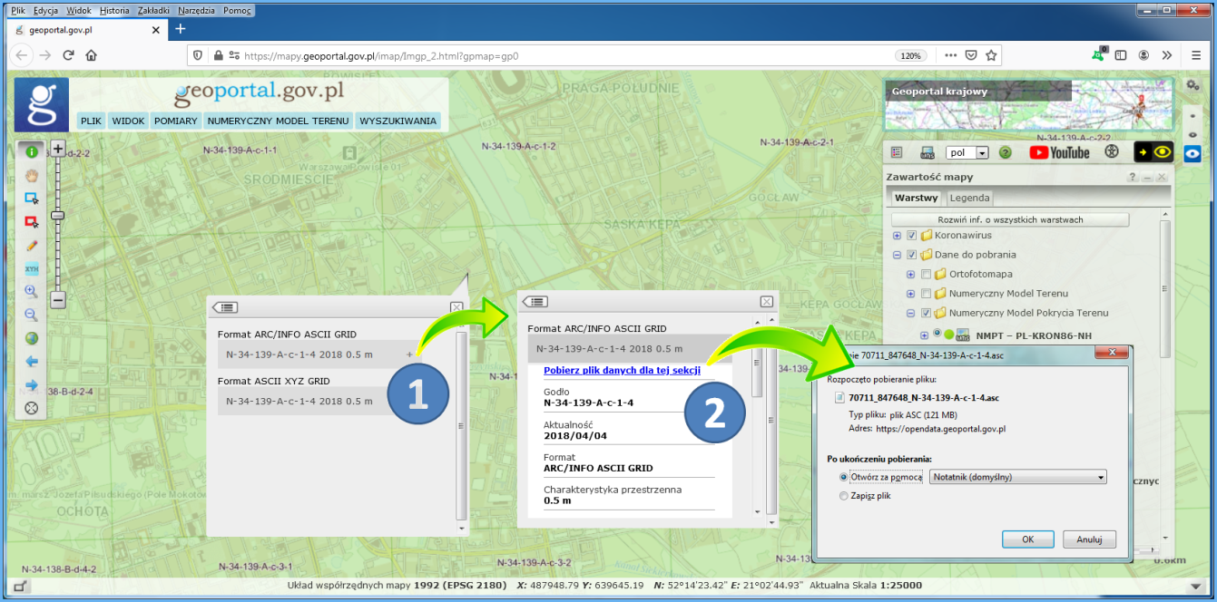
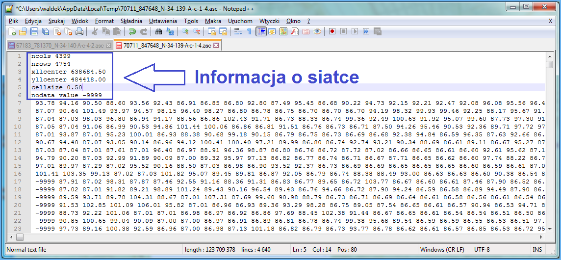
W rezultacie opisanych działań plik z danymi NMPT zostanie pobrany na komputer użytkownika i w zależności od decyzji użytkownika wyświetlony w domyślnej aplikacji, co przedstawiono na rys. 4.
Pobieranie danych NMPT w serwisie www.geoportal.gov.pl realizowane jest przez usługi WMS w zależności od układu wysokościowego:
- https://mapy.geoportal.gov.pl/wss/service/PZGIK/NMPT/WMS/SkorowidzeWUkladzieKRON86
- https://mapy.geoportal.gov.pl/wss/service/PZGIK/NMPT/WMS/SkorowidzeWUkladzieEVRF2007
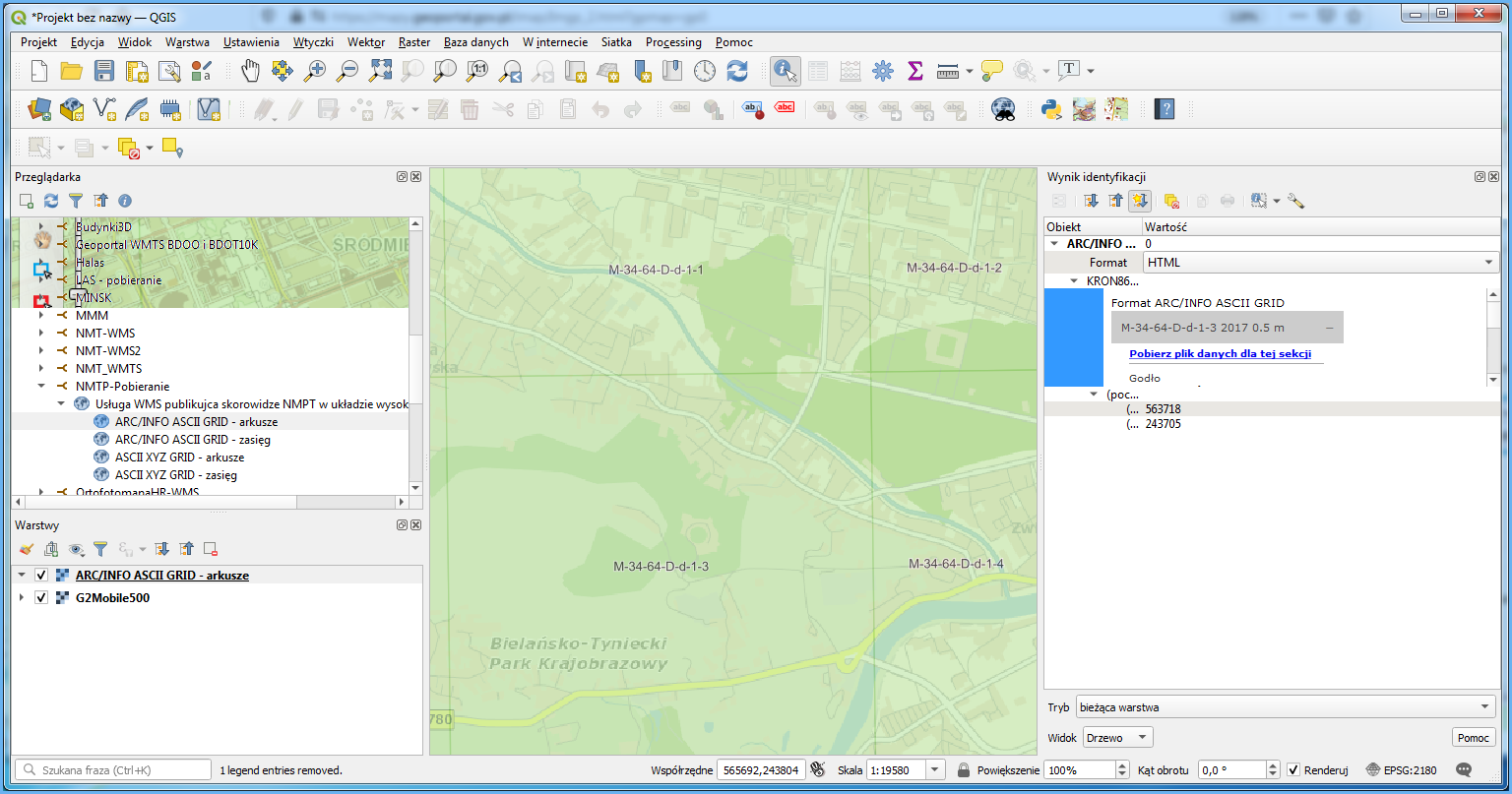
a konkretnie przez ich funkcję GetFeatureInfo, która w miejscu kliknięcia, jako atrybut udostępnia link do pobrania odpowiedniego pliku NMPT. Podłączając przedstawione usługi do programu QGIS lub innego możemy także w tych programach dokonywać bezpośredniego pobierania danych NMPT (rys. 5).
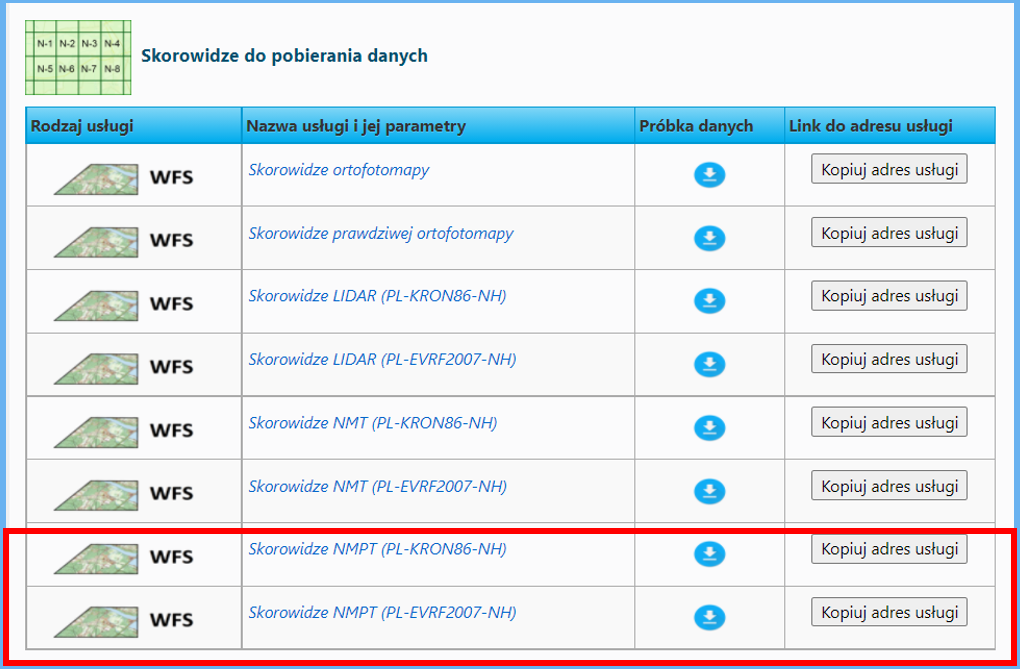
Alternatywnym sposobem pobierania danych NMPT jest wykorzystanie usług WFS (rys. 6), prezentujących skorowidze Numerycznego Modelu Pokrycia Terenu (NMPT) dostępnego w Państwowym Zasobie Geodezyjnym i Kartograficznym.
- Pierwsza z usług prezentuje NMPT w podziale na poszczególne lata (od 2000 do 2019) w układzie wysokościowym PL-KRON86-NH we wszystkich dostępnych formatach.
- Druga z usług prezentuje NMPT w podziale na poszczególne lata (od 2018 do 2021) w układzie wysokościowym PL-EVRF2007-NH we wszystkich dostępnych formatach.
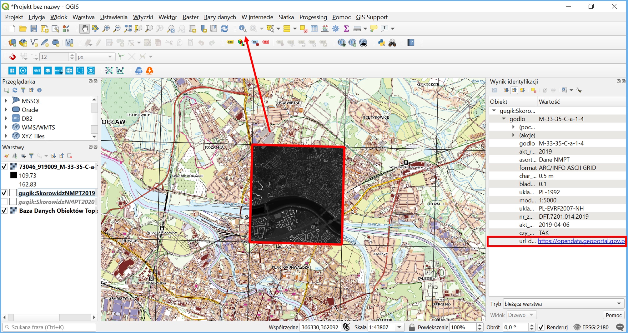
Aby pobrać skorowidze NMPT można skorzystać z dowolnego oprogramowania z funkcją klienta WFS, np. QGIS. Mając arkusze widoczne w skorowidzu można w łatwy sposób pobrać treść poszczególnych arkuszy NMPT. Realizujemy to korzystając z narzędzia „Informacja o obiekcie”, które po kliknięciu w dany arkusz wyświetli jego metadane, a w szczególności „Link do pobrania”, za pomocą którego można pobrać dane pomiarowe NMPT.
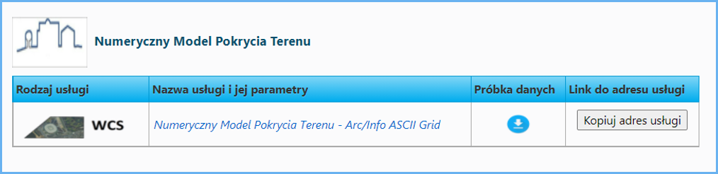
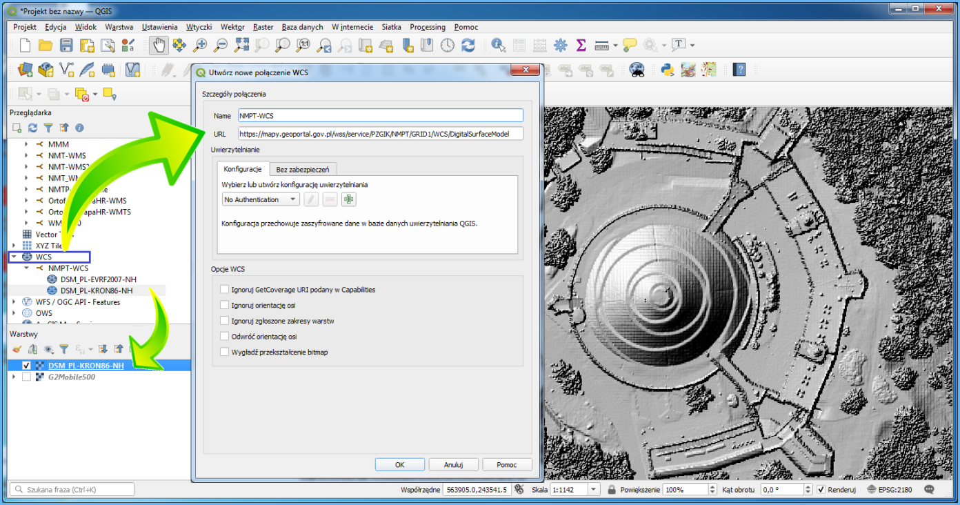
Innym sposobem pobierania NMPT jest wykorzystanie dostępnych usług WCS, których adresy publikowane są na stronie www.geoportal.gov.pl:
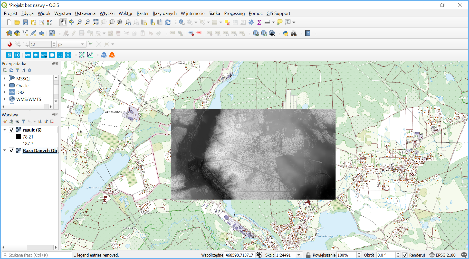
Usługi WCS najwygodniej podłączyć w programie QGIS jako źródło danych, jak przedstawiono to na rys. 9.
Po utworzeniu warstwy w projekcie QGIS, usługa generuje obraz NMPT dla przeglądanego obszaru. Jeśli chcemy fragment NMPT zapisać w postaci pliku, należy skorzystać z opcji eksportu, co zilustrowano poniżej.
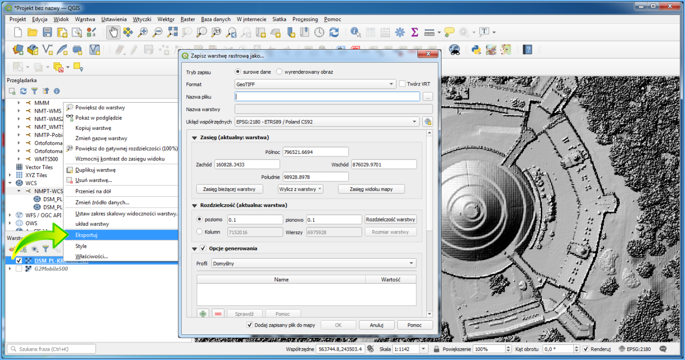
W wyniku przedstawionych działań na dysku uzyskujemy plik zgodny z ustawieniami, który jest odpowiednim wycinkiem surowych danych NMPT lub wyrenderowanego obrazu. Ze względów technicznych w usłudze WCS zasięg obszaru do jednorazowego pobierania danych jest ograniczony, ale bez problemu usługa nadaje się do pobierania fragmentów w zakresie kilkunastu arkuszy oryginalnego NMPT.
Możliwość pobrania NMPT z wykorzystaniem usługi WCS jest również realizowana wprost w serwisie www.geoportal.gov.pl za pomocą narzędzia – „Pobierz dane z usługi WCS”. Dostęp do funkcjonalności znajduje się na pasku narzędzi umieszczonym w lewej części interfejsu użytkownika aplikacji mapowej, jak przedstawiono to na poniższej ilustracji:
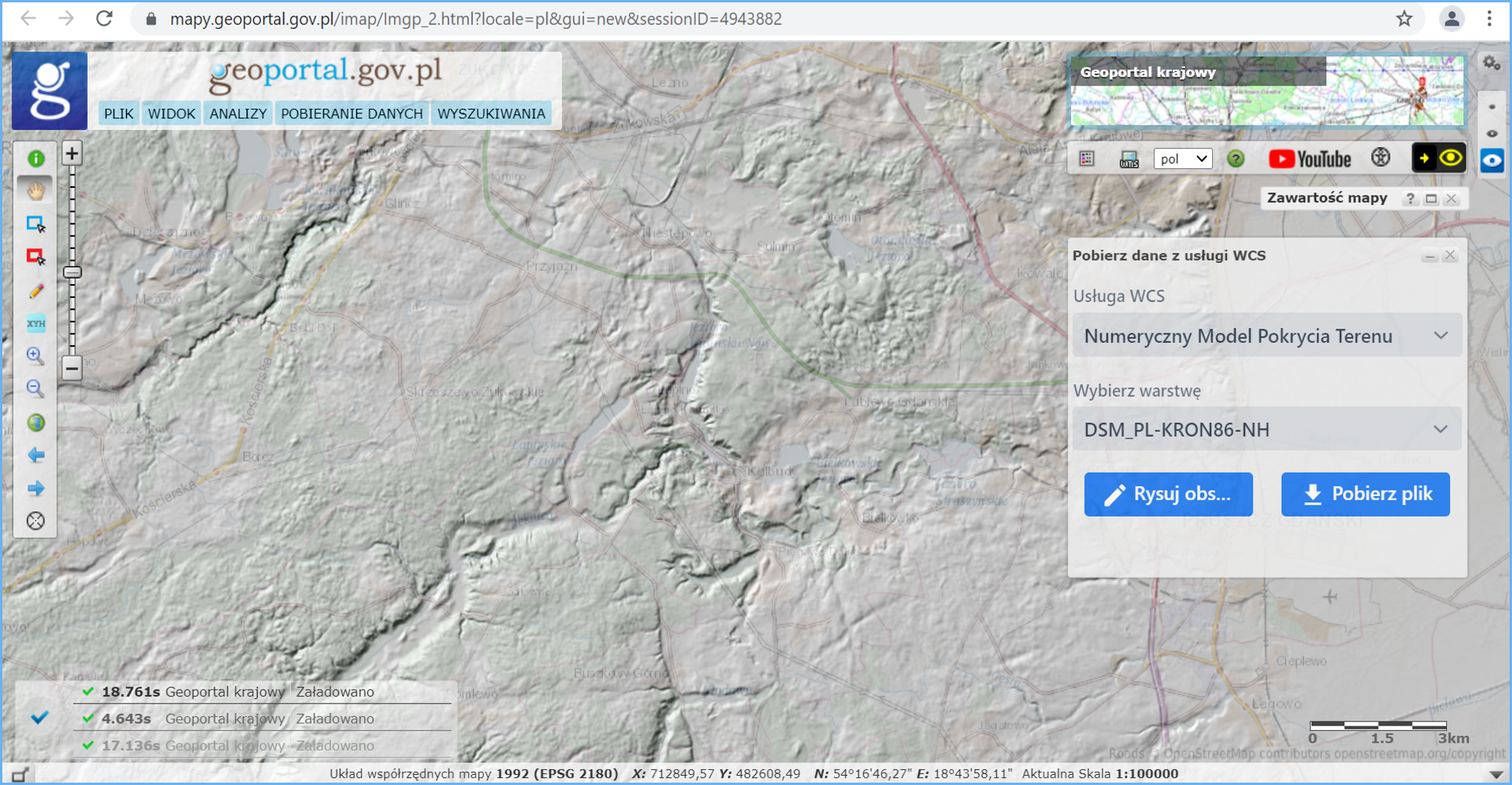
Aby pobrać dane należy kliknąć na ikonę narzędzia, następnie w wyświetlonym panelu wybrać dane do pobrania oraz narysować zasięg przestrzenny na mapie (maksymalnie 10 km2), co przedstawiono na rysunku 12.
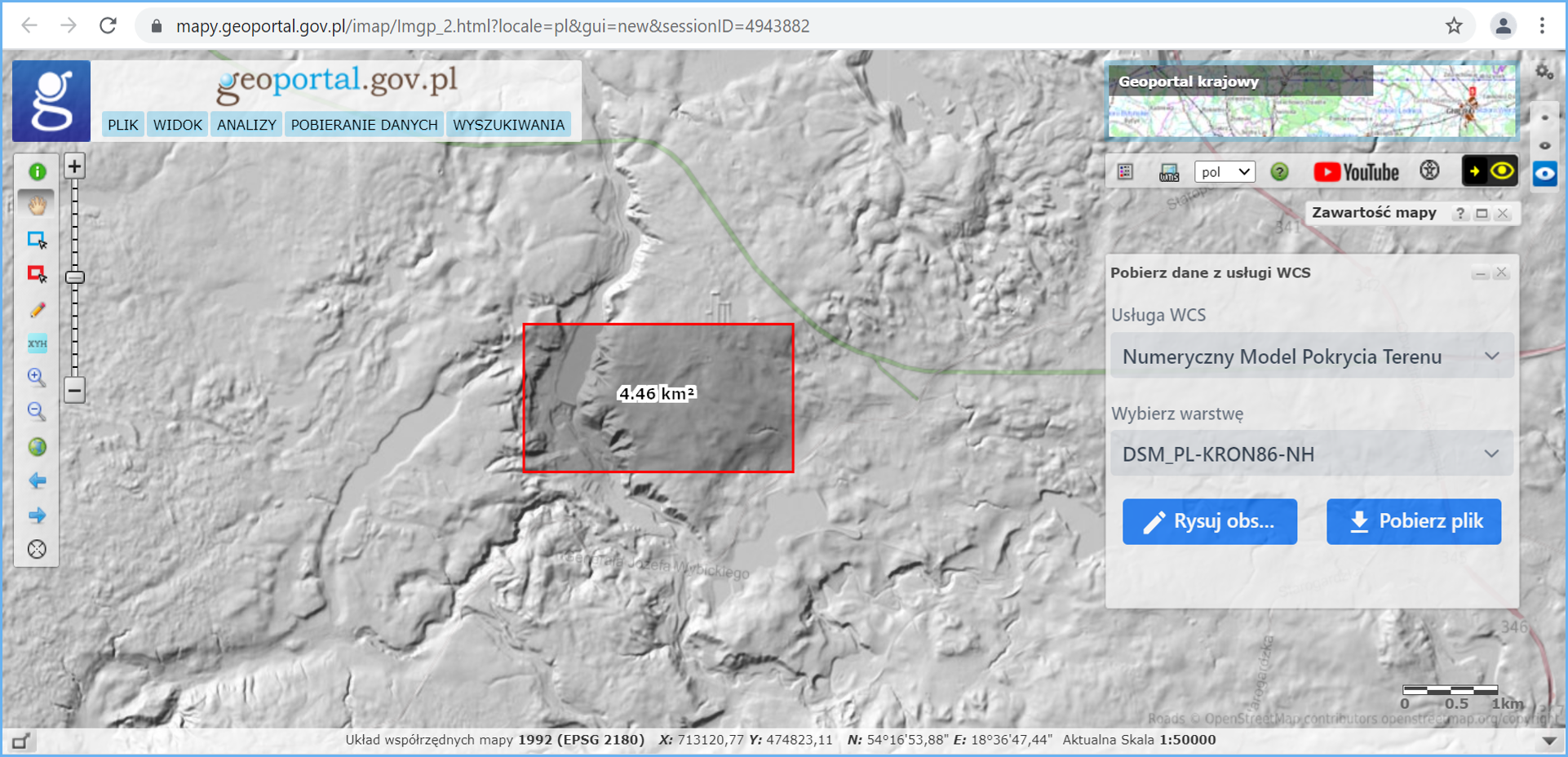
Po wykonaniu powyższych czynności należy już tylko pobrać przygotowany plik danych:
Narzędzie jest szczególnie przydatne w sytuacjach gdy obszar zainteresowania leży np. na 4 arkuszach i przy tradycyjnym pobieraniu musielibyśmy pobrać 4 arkusze, a potem dokonać ich sklejania. Korzystając z udostępnionej funkcjonalności mamy możliwość szybkiego pobrania gotowego fragmentu bez względu na układ arkuszy danych źródłowych.